
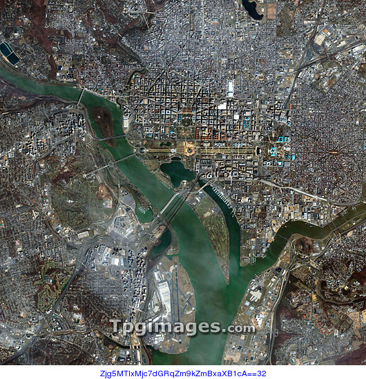
Washington DC. Satellite image of Washington DC, the capital city of the USA, and the surrounding area. Washington DC itself is at upper right, and the area just above centre includes landmarks such as the White House, US Capitol, and the Washington Monument. The Potomac River flows from upper left down to lower centre. The land at lower left is in the US State of Virginia, and includes Ronald Reagan Washington National Airport (lower centre) and the Pentagon (centre left). Image taken by the Ikonos satellite on 6 April 2004.
| px | px | dpi | = | cm | x | cm | = | MB |
Details
Creative#:
TOP01491271
Source:
達志影像
Authorization Type:
RM
Release Information:
須由TPG 完整授權
Model Release:
N/A
Property Release:
N/A
Right to Privacy:
No
Same folder images:
 Loading