
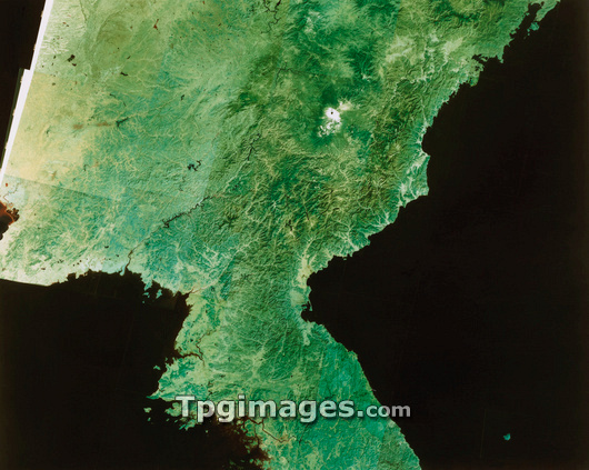
Satellite image of North Korea. The colours in this image have been processed to approximate to true tones. The border between North and South Korea runs from the estuary on the west coast (bottom centre) toward centre right. Just below this line is a brownish patch - this is Seoul, capital of South Korea. North Korea's border with China runs along the river left of centre, cuts below the white snow-capped volcano then almost parallel to the coast toward top right. The dominant mountain terrain (dark green) of North Korea is very evident, mixed with lowland scrub (pale green). This image is a mosaic of frames made by a Landsat satellite.
| px | px | dpi | = | cm | x | cm | = | MB |
Details
Creative#:
TOP03206475
Source:
達志影像
Authorization Type:
RM
Release Information:
須由TPG 完整授權
Model Release:
N/A
Property Release:
N/A
Right to Privacy:
No
Same folder images:
 Loading