
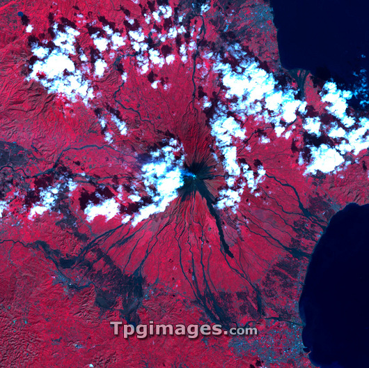
Mayon volcano, the Philippines, infrared satellite image. North is at top. Clouds are white, the sea is black, and vegetation is red. This area is several kilometres across. The volcano (centre) is on the coast of the Albay Gulf, and towers over the cities of Legazpi and Daraga (lower right, grey). The dark brown patches seen around the southern slopes of the volcano are vast mudslides caused by heavy rainfall from Typhoon Durian. It is estimated that the mudslides killed over 1000 people. Mayon Volcano is a steep-sided peak that rises to a height of 2462 metres, and the rain loosened loose layers of ash and rock, creating the deadly mudslides. Image obtained on 12 December 2006 by the ASTER sensor on the Terra satellite.
| px | px | dpi | = | cm | x | cm | = | MB |
Details
Creative#:
TOP03207468
Source:
達志影像
Authorization Type:
RM
Release Information:
須由TPG 完整授權
Model Release:
N/A
Property Release:
N/A
Right to Privacy:
No
Same folder images:
 Loading