
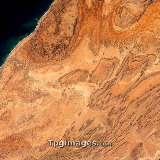
Anti-Atlas mountains, Morocco, satellite image. North is at top. This image covers an area around 70 kilometres across, and shows the south-western end of the Anti-Atlas Mountains. Most of the landscape consists of eroded mountains and rock structures called mesas (centre), and narrower mountain ridges (lower right). The landscape has formed over millions of years of erosion. Most of the landscape is a barren desert, but centre-pivot irrigation and agriculture occurs in the valley of the river flowing from centre to the Atlantic coast at upper left. At centre left, just to the left of one of the large mesas, is the city of Guelmine (grey). Image obtained on 19 March 2002 by the ETM+ sensor on the Landsat 7 satellite.
| px | px | dpi | = | cm | x | cm | = | MB |
Details
Creative#:
TOP03208326
Source:
達志影像
Authorization Type:
RM
Release Information:
須由TPG 完整授權
Model Release:
N/A
Property Release:
N/A
Right to Privacy:
No
Same folder images:
 Loading