
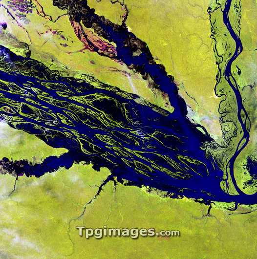
Amazon Basin river, satellite image. North is at top. Water is blue/black, vegetation is green, and barren areas (upper left) are red. This is the Negro River in northern Brazil, the Amazon River's largest tributary. The mosaic of mid-stream islands disappears when rainy season storms raise the water level. The land surrounding the river is covered in dense tropical rainforest. The area shown in this image is around 60 kilometres wide. The image data was obtained on 31 August 2000, by the Landsat 7 satellite.
| px | px | dpi | = | cm | x | cm | = | MB |
Details
Creative#:
TOP03208365
Source:
達志影像
Authorization Type:
RM
Release Information:
須由TPG 完整授權
Model Release:
N/A
Property Release:
N/A
Right to Privacy:
No
Same folder images:
 Loading