
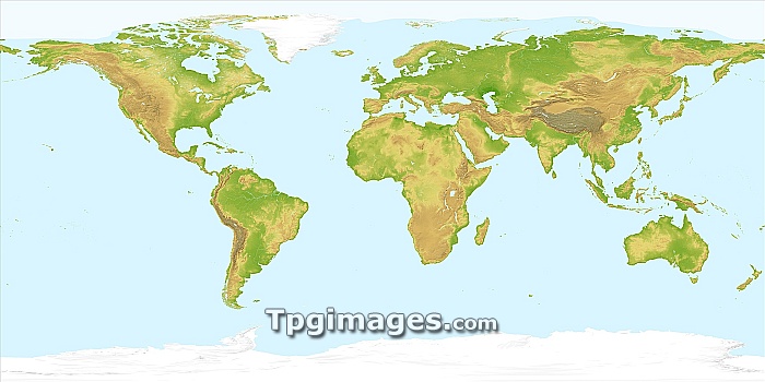
World land topography, satellite image. Height is colour-coded from green at sea level, through yellow to grey-brown for the highest mountains. Areas of permanent snow or ice cover are shown in white, as is typical summer sea ice extent in the Arctic Ocean. The land satellite imagery is from the AVHRR sensor on the NOAA Polar Orbiter weather satellites. Land topography data was obtained with radar measurements from the Space Shuttle program. Coastlines, lakes, rivers and ice cover are overlaid from a digital map.
| px | px | dpi | = | cm | x | cm | = | MB |
Details
Creative#:
TOP06664504
Source:
達志影像
Authorization Type:
RM
Release Information:
須由TPG 完整授權
Model Release:
NO
Property Release:
NO
Right to Privacy:
No
Same folder images:
earthplanetregioncontinentoceanseaearthobservationgeographygeologyearthsciencesatelliteimagespaceshuttlesatellitesrtmavhrrpolarorbiter21stcenturyandescontinentalcontinentscylindricalprojectionfromspacegeographicalgeologicalglobalhimalayasislandislandslakeslandlandcovermountainmountainrangesmountainsnationaloceanicandatmosphericadministrationnoaaoceansplanetaryrangeriversrockiesrockymountainsseasshuttleradartopographymissiontopographictopographywaterworldworldwideafricaasiaeuropenorthamericasouthamericaaustraliaantarcticarcticeurasiaaustralasia"
"21stadministrationafricaamericaamericaandandesantarcticarcticasiaatmosphericaustralasiaaustraliaavhrrcenturycontinentcontinentalcontinentscovercylindricaleartheartheartheurasiaeuropefromgeographicalgeographygeologicalgeologyglobalhimalayasimageislandislandslakeslandlandmissionmountainmountainmountainsmountainsnationalnoaanorthobservationoceanoceanicoceansorbiterplanetplanetarypolarprojectionradarrangerangesregionriversrockiesrockysatellitesatellitescienceseaseasshuttleshuttlesouthspacespacesrtmtopographictopographytopographywaterworldworldwide
 Loading