
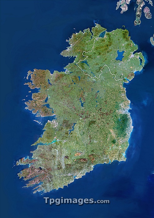
Ireland, satellite image. North is at top. Ireland is divided into Northern Ireland (in the north-east) and the Republic of Ireland, the border is shown in white. To the right is the Irish Sea, which separates the island from Great Britain, and to the left is the Atlantic Ocean. Image taken by the Landsat 5 satellite.
| px | px | dpi | = | cm | x | cm | = | MB |
Details
Creative#:
TOP06671862
Source:
達志影像
Authorization Type:
RM
Release Information:
須由TPG 完整授權
Model Release:
NO
Property Release:
NO
Right to Privacy:
No
Same folder images:
 Loading