
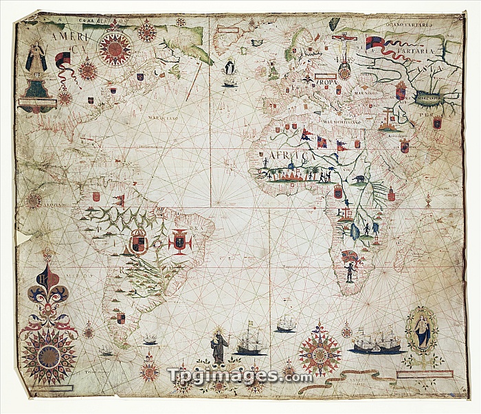
17th Century nautical map of the Atlantic Ocean. Historical portolan chart showing the Atlantic Ocean and adjacent continents. Portolan charts are navigational maps based on realistic descriptions of harbours and coasts. Along with the Atlantic, this chart shows the southeast Pacific Ocean, southwest Indian Ocean and the continents of South America, Africa, Europe, and parts of North America and Asia. Created by Pascal Roiz in 1633.
| px | px | dpi | = | cm | x | cm | = | MB |
Details
Creative#:
TOP06673172
Source:
達志影像
Authorization Type:
RM
Release Information:
須由TPG 完整授權
Model Release:
NO
Property Release:
NO
Right to Privacy:
No
Same folder images:
 Loading