
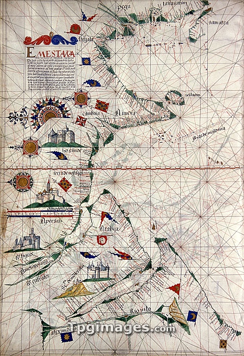
Portuguese sea chart. 16th century nautical chart of the coastlines of the Indian Ocean. North is at left. The chart shows the names of locations along the coastlines, and gives lines used for navigation at sea. Sumatra is at top right, India at upper centre, and the Arabian Peninsula at lower left. Nautical charts such as these were used during the Age of Discovery, that included the 1497-9 voyage of the Portuguese explorer Vasco da Gama, which opened the maritime trading route from Europe to India. This map is from a 1563 atlas by the Portuguese cartographer Lazaro Luis. The atlas is held at the Sciences Academy of Lisbon.
| px | px | dpi | = | cm | x | cm | = | MB |
Details
Creative#:
TOP06673795
Source:
達志影像
Authorization Type:
RM
Release Information:
須由TPG 完整授權
Model Release:
NO
Property Release:
NO
Right to Privacy:
No
Same folder images:
 Loading