
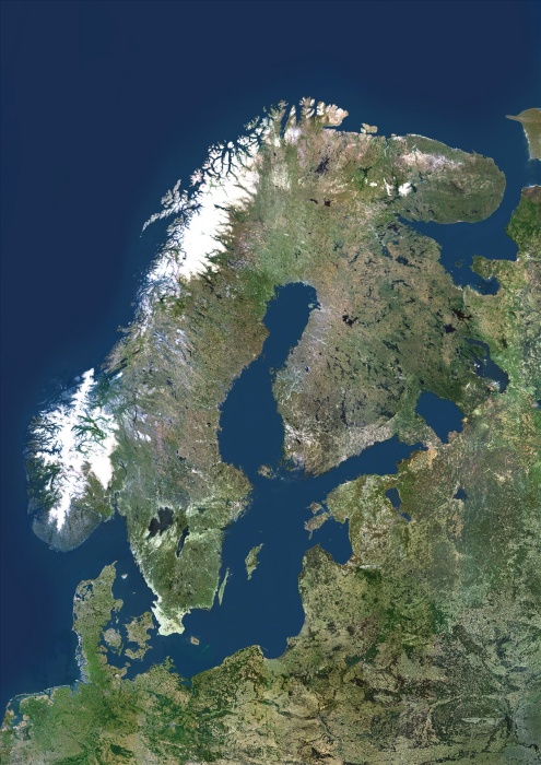
Scandinavia, True Colour Satellite Image. Scandinavia, true colour satellite image. The region comprises the countries of Norway (west coast of the peninsula at upper left), Sweden (on its east coast) and Denmark (small peninsula and islands west of southern Sweden). However, the term is often used to include Finland, across the Gulf of Bothnia to the east of Sweden. The Baltic Sea is at centre, with the thin Gulf of Finland (centre right) separating southern Finland from Estonia. Below Estonia on the east coast of the Baltic are Latvia and Lithuania. The south coast of the Baltic Sea is dominated by Poland (lower centre) and Germany (lower left). The image used data from LANDSAT 5 & 7 satellites.
| px | px | dpi | = | cm | x | cm | = | MB |
Details
Creative#:
TOP09061656
Source:
達志影像
Authorization Type:
RM
Release Information:
須由TPG 完整授權
Model Release:
NO
Property Release:
NO
Right to Privacy:
No
Same folder images:
 Loading