
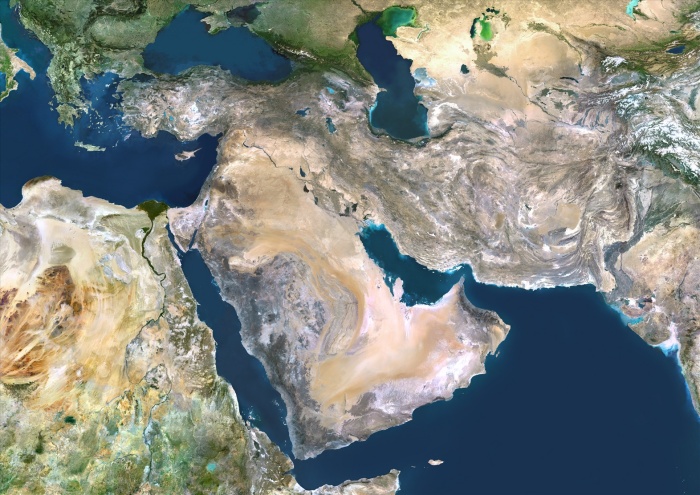
Middle East, True Colour Satellite Image. Middle East, true colour satellite image. North is at top. Vegetation is green, water is dark blue and bare ground, mostly desert, is yellow-brown. At centre is the Arabian Peninsula, mainly comprising Saudi Arabia, bordered on the left by the Red Sea and on the right by the Persian Gulf and the Arabian Sea (bottom right). Iran lies between the Caspian Sea (top right) and the Persian Gulf. To the right of Iran are Afghanistan and Pakistan, and to the left is Iraq. North-east Africa is at lower left. The Nile delta (green) of Egypt is clearly seen draining into the Mediterranean Sea (upper left). This image was compiled from data acquired by LANDSAT 5 & 7 satellites.
| px | px | dpi | = | cm | x | cm | = | MB |
Details
Creative#:
TOP09061664
Source:
達志影像
Authorization Type:
RM
Release Information:
須由TPG 完整授權
Model Release:
NO
Property Release:
NO
Right to Privacy:
No
Same folder images:
 Loading