
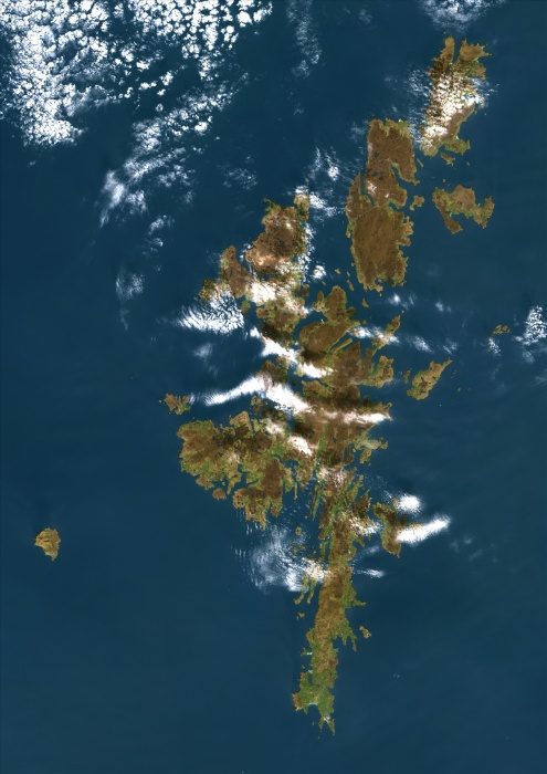
Shetland, Scotland, Uk, True Colour Satellite Image. True colour satellite image of the Shetland, an archipelago in Scotland (UK), off the northeast coast. The islands lie between the Atlantic ocean and the Norwegian sea to the West and the North Sea to the East. The main island of the group is known as Mainland. Image taken on 14 May 2000 using LANDSAT 7 data.
| px | px | dpi | = | cm | x | cm | = | MB |
Details
Creative#:
TOP09062796
Source:
達志影像
Authorization Type:
RM
Release Information:
須由TPG 完整授權
Model Release:
NO
Property Release:
NO
Right to Privacy:
No
Same folder images:
 Loading