
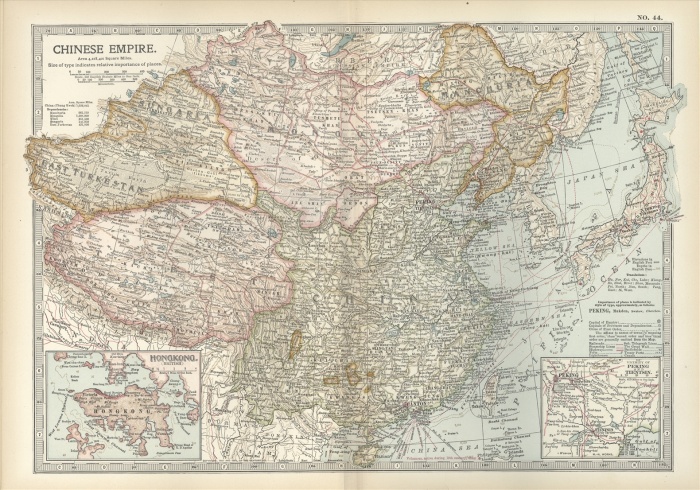
Map showing the historical boundaries of the Chinese Empire, with insets of Hong Kong, Peking (now Beijing), and Tientsin, circa 1902, from the 10th edition of Encyclopaedia Britannica.
| px | px | dpi | = | cm | x | cm | = | MB |
Details
Creative#:
TOP09069786
Source:
達志影像
Authorization Type:
RM
Release Information:
須由TPG 完整授權
Model Release:
No
Property Release:
No
Right to Privacy:
No
Same folder images:
 Loading