
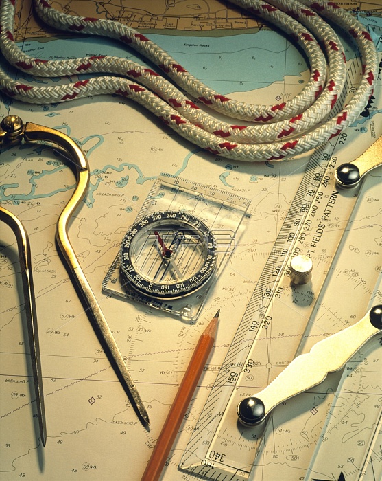
Navigational sailing equipment on a nautical chart. At left are some dividers, a pair of compasses for measuring distances on the map. In the centre is a Silva compass, for use in conjunction with the map for finding directions. It consists of a fluid-damped, magnetised needle fixed to a plastic ruler base. The needle becomes aligned to the local component of the Earth's magnetic field, resting North to South. At right is a parallel ruler, an instrument used, again in conjunction with the chart, to calculate courses.
| px | px | dpi | = | cm | x | cm | = | MB |
Details
Creative#:
TOP10190168
Source:
達志影像
Authorization Type:
RM
Release Information:
須由TPG 完整授權
Model Release:
N/A
Property Release:
N/A
Right to Privacy:
No
Same folder images:
 Loading