
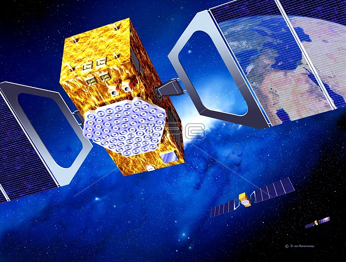
Galileo navigation satellite network. Artwork of several navigation satellites for the European Galileo network, orbiting over Europe (reflection, top right, shows the Mediterranean Sea). Galileo will be a civilian global positioning system (GPS) that will consist of 30 satellites orbiting over 23,000 kilometres above the Earth. Galileo will be more accurate than, and compatible with, the other GPS systems. Applications include car, train and aircraft guidance, rescue services, and road use taxation. Each satellite is seen with solar panels (blue) to provide power. The complete network is scheduled to operate from 2008.
| px | px | dpi | = | cm | x | cm | = | MB |
Details
Creative#:
TOP10226240
Source:
達志影像
Authorization Type:
RM
Release Information:
須由TPG 完整授權
Model Release:
N/A
Property Release:
N/A
Right to Privacy:
No
Same folder images:
 Loading