
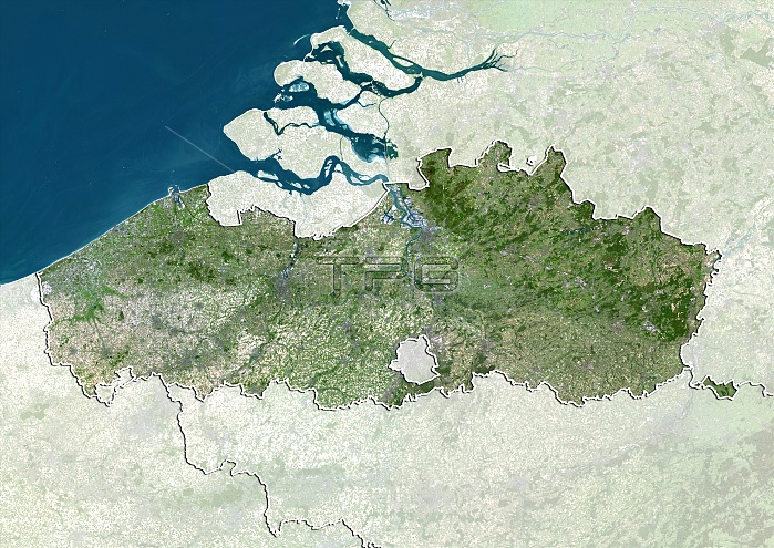
Flanders, Belgium. North is at top. Natural colour satellite image showing the Flemish region of Belgium, with the surrounding regions shaded out. Belgium is bordered by France (lower left), Germany (right), Luxembourg (not shown), the Netherlands (Holland, top), and the North Sea (blue). It is divided into three regions: Walloon Region (Wallonia, bottom right), Flemish Region (Flanders, green), and Brussels-Captial Region (Brussels, small, centre). Image compiled from data acquired by the LANDSAT 5 and 7 satellites, in 2000. Images highlighting all other regions of this country are available. For further information please contact SPL.
| px | px | dpi | = | cm | x | cm | = | MB |
Details
Creative#:
TOP10277435
Source:
達志影像
Authorization Type:
RM
Release Information:
須由TPG 完整授權
Model Release:
NO
Property Release:
NO
Right to Privacy:
No
Same folder images:
 Loading