
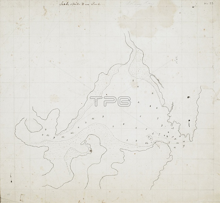
Cook's chart of Botany Bay, illustration. Chart of Botany Bay, New South Wales, Australia, made during Captain Cook's First Voyage in 1770. From 'Charts and maps illustrating the voyages and surveys of Captain James Cook and other discoverers', 1770.
| px | px | dpi | = | cm | x | cm | = | MB |
Details
Creative#:
TOP15203253
Source:
達志影像
Authorization Type:
RM
Release Information:
須由TPG 完整授權
Model Release:
No
Property Release:
No
Right to Privacy:
No
Same folder images:
1700s177018thcenturyartworkaustraliaaustralianbotanybaybritishcaptaincookcartographychartchartsandmapsillustratingthevoyagesandsurveysofcaptainjamescookandotherdiscovererscontinentcontinentsdiscoveryeuropeanexplorationextractfirstvoyagegeographicalgeographyhistoricalhistoryillustrationjamescookmanuscriptmapnewsouthwalesno-onenobodypacificocean
1700s177018thandandandartworkaustraliaaustralianbaybotanybritishcaptaincaptaincartographycenturychartchartscontinentcontinentscookcookcookdiscoverersdiscoveryeuropeanexplorationextractfirstgeographicalgeographyhistoricalhistoryillustratingillustrationjamesjamesmanuscriptmapmapsnewno-onenobodyoceanofotherpacificsouthsurveysthevoyagevoyageswales
 Loading