
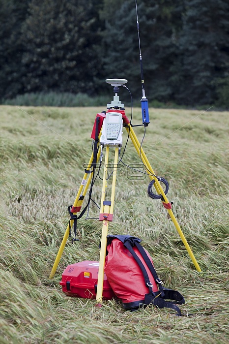
A differential GPS being used in real time kinematic survey, to survey the extent of the Durham canyon flooding feature, UK.
| px | px | dpi | = | cm | x | cm | = | MB |
Details
Creative#:
TOP16005007
Source:
達志影像
Authorization Type:
RM
Release Information:
須由TPG 完整授權
Model Release:
N/A
Property Release:
N/A
Right to Privacy:
No
Same folder images:
accuracyaccurateagriculturebarleycanyonchannelclimatechangecollapsedamagedestroyeddestructiondifferentialgpsdurhamerodederosionfarmingfeaturefieldfloodfloodinggeographygeomorphologyglobalpositioningsystemglobalwarminggpsgullynaturaldisasternortheastrainrealtimekinematicsurveyriverriverwearsciencescientistsevereweathersoilstudysurveysurveyingtripodukwearweather
accuracyaccurateagriculturebarleycanyonchangechannelclimatecollapsedamagedestroyeddestructiondifferentialdisasterdurhameasterodederosionfarmingfeaturefieldfloodfloodinggeographygeomorphologyglobalglobalgpsgpsgullykinematicnaturalnorthpositioningrainrealriverriversciencescientistseveresoilstudysurveysurveysurveyingsystemtimetripodukwarmingwearwearweatherweather
 Loading