
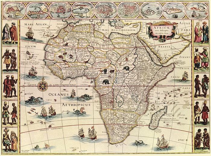
Map of Africa. 17th-century map of the continent of Africa, with illustrations of major cities (across top) and indigenous peoples (down left and right). Animals (elephants, monkeys, ostriches, gazelles, lions, cheetahs and camels) are shown on land, with ships and sea creatures in the oceans. The labels are in Latin, as is the title: 'Africae nova descriptio'. The nine cities across top are (from left): Tangier, Ceuta, Algiers, Tunis, Alexandria, Cairo (Alcair), the island of Mozambique, the mine at St George in Guinea, and Canaria (Canary Islands). This 1640 map by Dutch map-maker Willem Janszoon Blaeu (1571-1638) was published in Amsterdam in the 1660s.
| px | px | dpi | = | cm | x | cm | = | MB |
Details
Creative#:
TOP16028983
Source:
達志影像
Authorization Type:
RM
Release Information:
須由TPG 完整授權
Model Release:
N/A
Property Release:
N/A
Right to Privacy:
No
Same folder images:
 Loading