
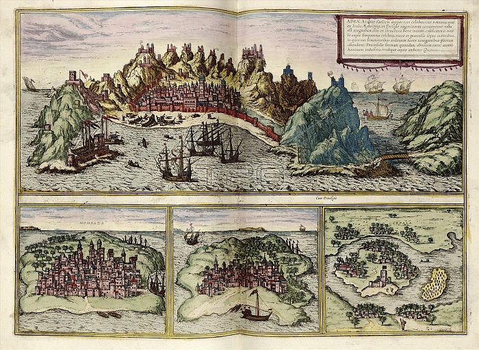
East African ports. 16th-century illustrations of four ports along the eastern coast of Africa, mostly under the control of sultans of the Ottoman Empire but also key parts of the trade route between Europe and Asia. Across top: Aden (Aden in present-day Yemen) with Portuguese ships. Below, from left to right are: Mombaza (Mombasa in present-day Kenya); Qviloa (Kilwa in present-day Tanzania); and Cefala (Sofala in present-day Mozambique). This is a 1612 edition of a map first published in volume 1 (1572) of the city atlas 'Civitates orbis terrarum'. This atlas was edited by Georg Braun (c.1540-1622) and largely engraved by Franz Hogenberg.
| px | px | dpi | = | cm | x | cm | = | MB |
Details
Creative#:
TOP16313386
Source:
達志影像
Authorization Type:
RM
Release Information:
須由TPG 完整授權
Model Release:
N/A
Property Release:
N/A
Right to Privacy:
No
Same folder images:
 Loading