
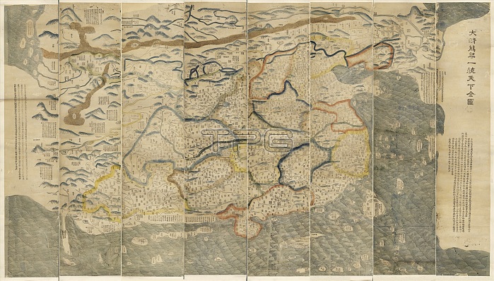
Map of China. 19th-century copy of an 18th-century map showing the world as seen from China (centre). The map is titled: 'Da Qing wan nian yi tong tian xia quan tu' (The great Qing Dynasty's complete map of all under heaven). The map area extends from Korea (upper right) to India (left), and from Russia (top) to Brunei (lower right). The provinces of China are marked with coloured boundaries. The Great Wall of China is shown as the northern and north-eastern boundary. Islands at top left on such maps often indicated the location of European and African locations. This 1811 copy of the map is based on a 1767 original by Huang Qianren.
| px | px | dpi | = | cm | x | cm | = | MB |
Details
Creative#:
TOP16313545
Source:
達志影像
Authorization Type:
RM
Release Information:
須由TPG 完整授權
Model Release:
N/A
Property Release:
N/A
Right to Privacy:
No
Same folder images:
 Loading