
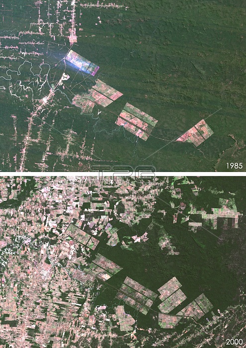
Matto Grosso deforestation. Satellite images of Matto Grosso, Brazil, in 1985 (top) and 2000 (bottom), showing the impact of deforestation. Urban areas are grey and vegetation is green.
| px | px | dpi | = | cm | x | cm | = | MB |
Details
Creative#:
TOP16630918
Source:
達志影像
Authorization Type:
RM
Release Information:
須由TPG 完整授權
Model Release:
N/A
Property Release:
N/A
Right to Privacy:
No
Same folder images:
1985200020thcentury21stcenturybrasilbrasilianbrazilbraziliancartographychangecitycomparedcomparingcomparisoncountriescountrydeforestationearthobservationenvironmentenvironmentalsciencefromabovefromspacegeographicalgeographyimpactlandlandusemapmattogrossono-onenobodysatelliteimagesouthamericasouthamericanspreadurbanurbanisation
1985200020th21staboveamericaamericanbrasilbrasilianbrazilbraziliancartographycenturycenturychangecitycomparedcomparingcomparisoncountriescountrydeforestationearthenvironmentenvironmentalfromfromgeographicalgeographygrossoimageimpactlandlandmapmattono-onenobodyobservationsatellitesciencesouthsouthspacespreadurbanurbanisationuse
 Loading