
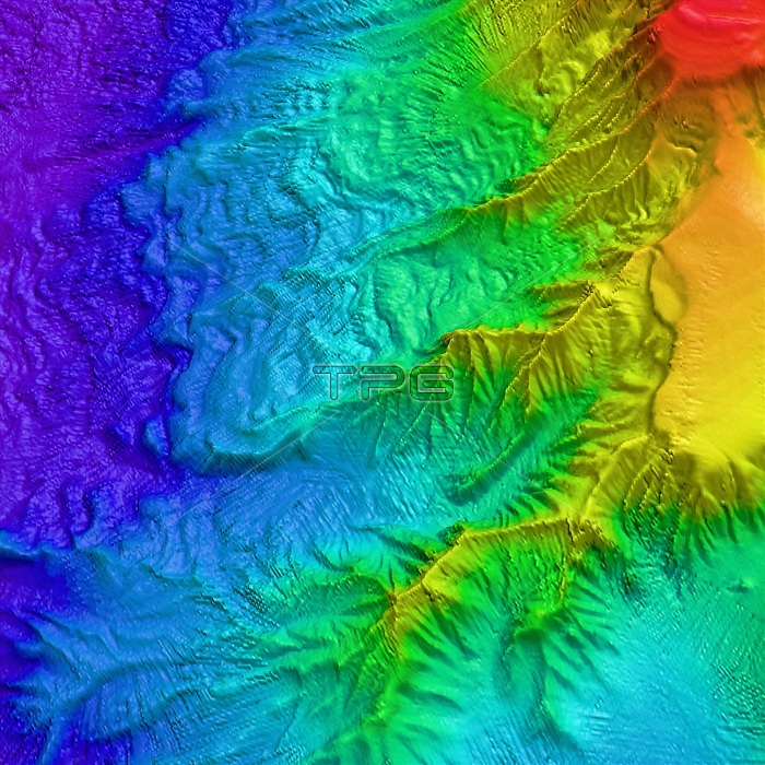
Saunders Island volcano, bathymetry. Map of ocean floor depth (bathymetry) north east of Saunders Island, South Sandwich Islands, in the southern Atlantic Ocean. Depth is colour-coded from shallow (red) to deep (purple). Deeply-eroded canyons are funnelling sediment down the slope of this active volcanic and glaciated island. Wave fields of the sediment can be seen across the slope. This high sedimentation rate indicates high erosion rates of the island. Data acquired by the hull-mounted Simrad EM120 multibeam echo-sounder on RRS James Clark Ross during BAS cruise JR206 between January and March 2010.
| px | px | dpi | = | cm | x | cm | = | MB |
Details
Creative#:
TOP16635637
Source:
達志影像
Authorization Type:
RM
Release Information:
須由TPG 完整授權
Model Release:
N/A
Property Release:
N/A
Right to Privacy:
No
Same folder images:
 Loading