
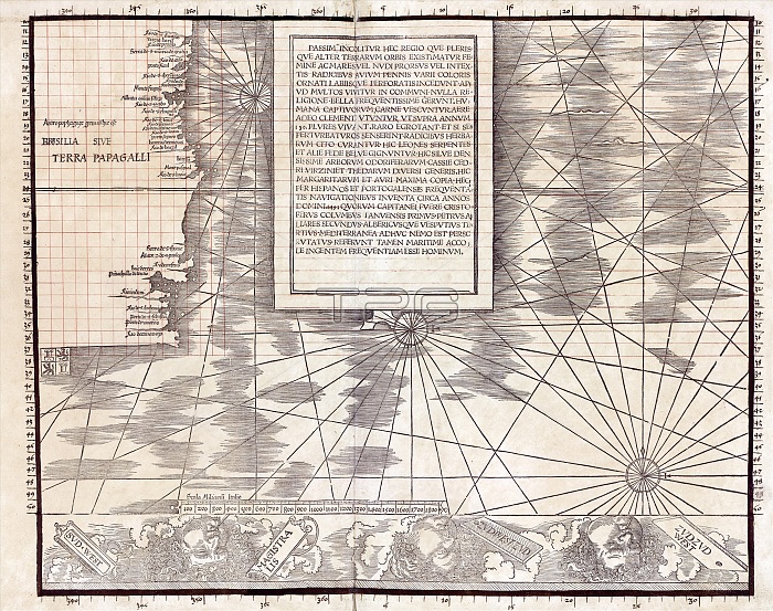
Section of Waldseemuller's Carta Marina. This is the second section of the bottom row of the 1516 Carta Marina world map, produced by German cartographer Martin Waldseemuller (c.1470-1520). This section shows a text block in the southern Atlantic and the newly discovered coasts of South America with the Spanish coat of arms. This map expanded upon Waldseemuller's earlier work of 1507. There are numerous illustrations of mythological creatures and travel stories. Text blocks (in Latin) describe different regions, and the border includes representations of the winds. The red grid lines were added by the map's owner, Johannes Schoner. For all 12 sections of this map, see images C032/2804 to C032/2815. For the map as a whole, see image C032/2803.
| px | px | dpi | = | cm | x | cm | = | MB |
Details
Creative#:
TOP19534303
Source:
達志影像
Authorization Type:
RM
Release Information:
須由TPG 完整授權
Model Release:
N/A
Property Release:
N/A
Right to Privacy:
No
Same folder images:
Restriction:
This image may not be used to state or imply ESA endorsement of any company or product
 Loading