
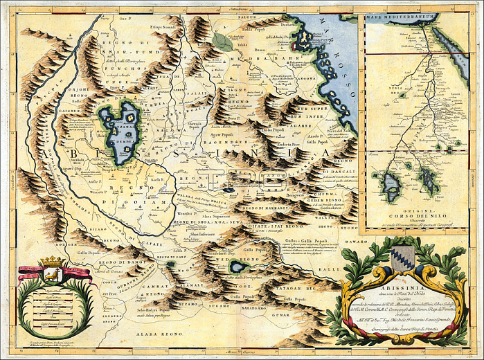
A Venetian cartographer; Coronelli (1650-1718) cites his sources for this Nile map; including the Portuguese Jesuits Pedro P醗z and Jer髇imo Lobo; and contrasts his work with an inset showing the "original" (that is; outdated) course of the Nile as presented by past geographers; who followed the Ptolemaic tradition of two source lakes.
P醗z and Lobo had visited Ethiopia in the early 1600s; and both gave accounts of having seen the springs that natives believed to be the river's source; though the Jesuits failed to distinguish between the two branches of the river. Coronelli's Nile is the Blue Nile; and his geography is fairly accurate for that branch; identifying the significance of Lake Tsana and the clockwise unfolding of the river as it descends from there.
| px | px | dpi | = | cm | x | cm | = | MB |
Details
Creative#:
TOP20153987
Source:
達志影像
Authorization Type:
RM
Release Information:
須由TPG 完整授權
Model Release:
No
Property Release:
No
Right to Privacy:
No
Same folder images:
 Loading