
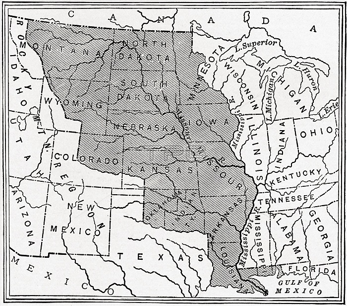
Map showing The Louisiana Purchase. The acquisition of the Louisiana territory (828,000 square miles) by the United States from France in 1803. From The History of Our Country, published 1900
| px | px | dpi | = | cm | x | cm | = | MB |
Details
Creative#:
TOP20773695
Source:
達志影像
Authorization Type:
RM
Release Information:
須由TPG 完整授權
Model Release:
No
Property Release:
No
Right to Privacy:
No
Same folder images:
 Loading