
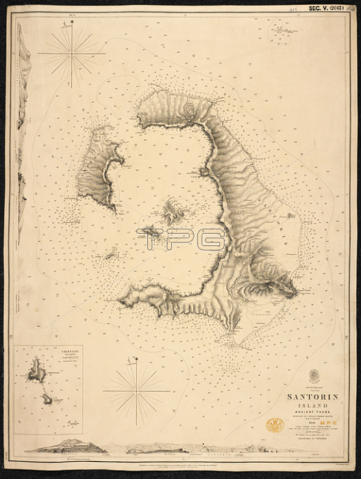
A chart of Santorin Island.[London]; 1851.From: S. Island; ancient Thera. Surveyed by Capt. T. Graves. 1848. [Admiralty Chart].Maps SEC. 5. (2043.) London; British Library.
| px | px | dpi | = | cm | x | cm | = | MB |
Details
Creative#:
TOP20994975
Source:
達志影像
Authorization Type:
RM
Release Information:
須由TPG 完整授權
Model Release:
No
Property Release:
No
Right to Privacy:
No
Same folder images:
Restriction:
Additional permissions needed for non-editorial use.
 Loading