
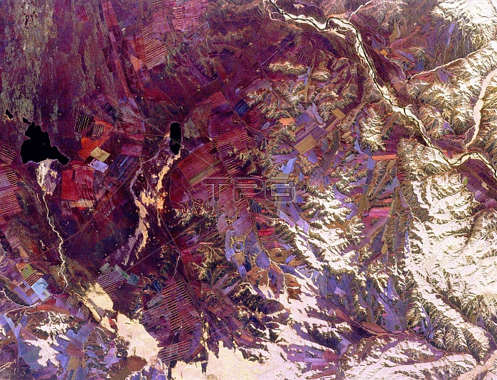
Spaceborne radar image shows part of the remote central Asian region of Tuva, an autonomous republic of the Russian Federation. Tuva is a mostly mountainous region that lies between western Mongolia and southern Siberia. Most of the red, pink and blue areas in the image are agricultural fields of a large collective farming complex that was developed during the era of the Soviet Union. Traditional agricultural activity in the region, still active in remote areas, revolves around practices of nomadic livestock herding. White areas on the image are north-facing hillsides, which develop denser forests than south-facing slopes. The river in the upper right is one of the two major branches of the Yenesey River. Image was acquired by SIR-C/X-SAR onboard the Endeavour on October 1, 1994. The image is 35 x 46 miles and is centered at 51.5 degrees north latitude, 95.1 degrees east longitude. North is toward the upper right. The colors are assigned to different radar fequencies and polarizations of the radar as follows: red is L-band, horizontally transmitted and received; green is L-band, horizontally transmitted and vertically received; and blue is C-band, horizontally transmitted and vertically received.
| px | px | dpi | = | cm | x | cm | = | MB |
Details
Creative#:
TOP22083157
Source:
達志影像
Authorization Type:
RM
Release Information:
須由TPG 完整授權
Model Release:
N/A
Property Release:
No
Right to Privacy:
No
Same folder images:
 Loading