
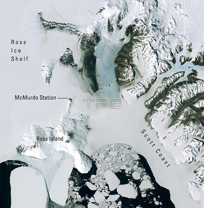
Satellite image acquired on December 27, 2001 by the Enhanced Thematic Mapper Plus (ETM+) sensor onboard Landsat 7, which displays a portion of the natural color mosaic over McMurdo Station, the largest research base in Antarctica. Ross Island is roughly 45 miles across at its widest point. This image is part of the Landsat Image Mosaic of Antarctica (LIMA). The project was developed by the U.S. Geological Survey, the British Antarctic Survey, and NASA, with funding from the National Science Foundation.
| px | px | dpi | = | cm | x | cm | = | MB |
Details
Creative#:
TOP22083490
Source:
達志影像
Authorization Type:
RM
Release Information:
須由TPG 完整授權
Model Release:
N/A
Property Release:
No
Right to Privacy:
No
Same folder images:
 Loading