
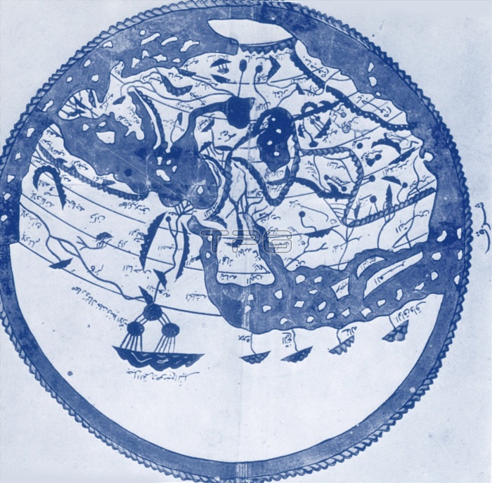
Arab geographers understood the outlines of Asia, Europe and North Africa by VI/12th century; their knowledge was summed up by the great atlas of al-Idrisi of 549/1154. It places south at the top; the map is inverted to make it easily recognizable.
| px | px | dpi | = | cm | x | cm | = | MB |
Details
Creative#:
TOP22156356
Source:
達志影像
Authorization Type:
RM
Release Information:
須由TPG 完整授權
Model Release:
N/A
Property Release:
No
Right to Privacy:
No
Same folder images:
 Loading