
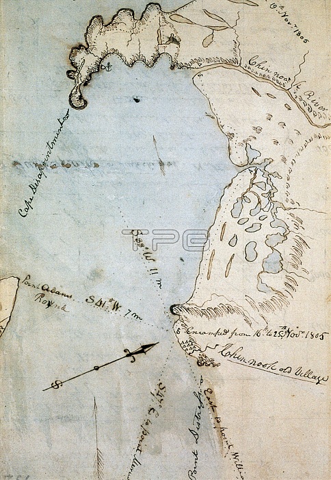
Map of Gray's Bay, in Pacific and Wahkiakum counties, Washington state, made by William Clark (of Lewis & Clark) in November 1805. The bay was originally mistaken for the Pacific ocean, leading to the moniker of "Cape Disappointment" visible on the upper left. Commissioned by President Thomas Jefferson and led by Meriwether Lewis and William Clark, the expedition had several goals; to study the area's plants, animal life, and geography, to discover how the region could be exploited economically and to find a direct and practicable water route for commerce with Asia (the Northwest Passage).They were accompanied by a fifteen-year-old Shoshone Indian woman, Sacagawea, the wife of a French-Canadian fur trader. After crossing the Rocky Mountains, the expedition reached the Pacific Ocean in present-day Oregon in November 1805. They returned in 1806, bringing with them an immense amount of information about the region as well as numerous plant and animal specimens.
| px | px | dpi | = | cm | x | cm | = | MB |
Details
Creative#:
TOP22160976
Source:
達志影像
Authorization Type:
RM
Release Information:
須由TPG 完整授權
Model Release:
N/A
Property Release:
No
Right to Privacy:
No
Same folder images:
 Loading