
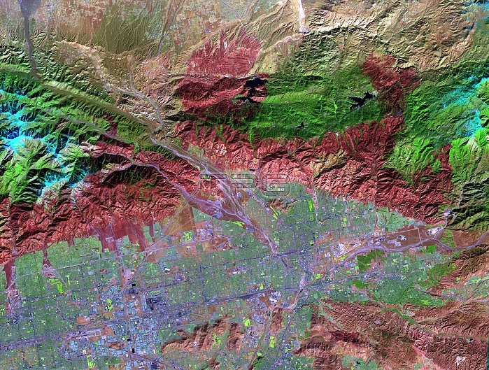
On November 18, 2003, the ASTER on NASA's Terra satellite acquired this image of the Old Fire/Grand Prix fire east of Los Angeles. The image will be processed by NASA's Wildfire Response Team and sent to the USDA's Forest Service Remote Sensing Applications Center (RSAC) which provides interpretation services to Burned Area Emergency Response (BAER) teams to assist in mapping the severity of the burned areas. The image combines data from the visible and infrared wavelength regions to highlight the burned areas. ASTER is one of five Earth-observing instruments launched December 18, 1999, on NASA's Terra satellite. The broad spectral coverage and high spectral resolution of ASTER provides scientists in numerous disciplines with critical information for surface mapping, and monitoring of dynamic conditions and temporal change. The Terra mission is part of NASA's Earth Science Enterprise, a long- term research effort dedicated to understanding the Earth as an integrated system and applying Earth System Science to improve prediction of climate, weather, and natural hazards using the unique vantage point of space.
| px | px | dpi | = | cm | x | cm | = | MB |
Details
Creative#:
TOP22309716
Source:
達志影像
Authorization Type:
RM
Release Information:
須由TPG 完整授權
Model Release:
N/A
Property Release:
No
Right to Privacy:
No
Same folder images:
 Loading