
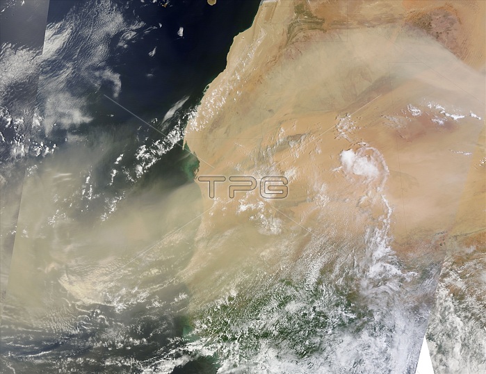
A late July, 2013 Saharan dust storm continued through the end of the month, as strong winds blew dust high aloft and thousands of kilometers over western Africa and across the tropical Atlantic Ocean. The Moderate Resolution Imaging Spectroradiometer (MODIS) flying aboard NASA's Terra satellite passed over the region on July 31 and captured this true-color image of the massive event. Broad swirls of dust can be seen blowing westward over the arid land, crossing parts of Algeria (upper right), Western Sahara (northeast coast) and most of Mauritania (center), Mali (southeast), and, on the southern coast, Senegal, the Gambia and Guinea-Bissau. The Cape Verde Islands, a group of 10 islands located in the Atlantic Ocean about 350 miles (570 km) west of southern Mauritania, have been completely obscured by an extremely thick wave of deep tan dust. This image was created as a mosaic of several MODIS swaths, combining them to create a broad view across both land and sea. However, the size of the dust storm exceeds the bounds of this image, and extends both to the east and to the west.
| px | px | dpi | = | cm | x | cm | = | MB |
Details
Creative#:
TOP22313567
Source:
達志影像
Authorization Type:
RM
Release Information:
須由TPG 完整授權
Model Release:
N/A
Property Release:
No
Right to Privacy:
No
Same folder images:
 Loading