
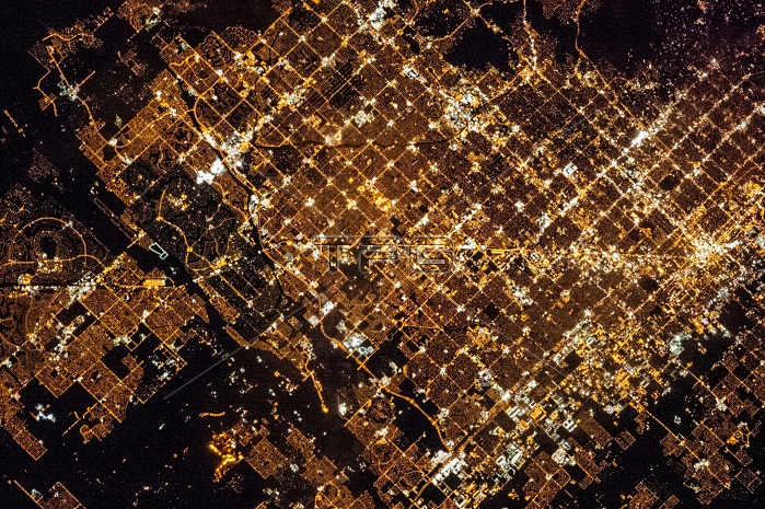
A view of Phoenix, Arizona, showing its metropolitan area laid out along a regular grid of city blocks and streets. While visible during the day, this grid is most evident at night, when the pattern of street lighting is clearly visible from the low-Earth orbit vantage point of the International Space Station. This astronaut photograph includes parts of several cities in the metro area, including Phoenix (image right), Glendale (center), and Peoria (left). While the major street grid is oriented north-south, the northwest-southeast oriented Grand Avenue cuts across it at image center. While much of the land area highlighted in this image is urbanized, there are several noticeably dark areas. The Phoenix Mountains are largely public parks and recreational land. To the west, agricultural fields provide a sharp contrast to the lit streets of residential developments. The Salt River channel appears as a dark ribbon within the urban grid.
| px | px | dpi | = | cm | x | cm | = | MB |
Details
Creative#:
TOP22313584
Source:
達志影像
Authorization Type:
RM
Release Information:
須由TPG 完整授權
Model Release:
N/A
Property Release:
No
Right to Privacy:
No
Same folder images:
 Loading