
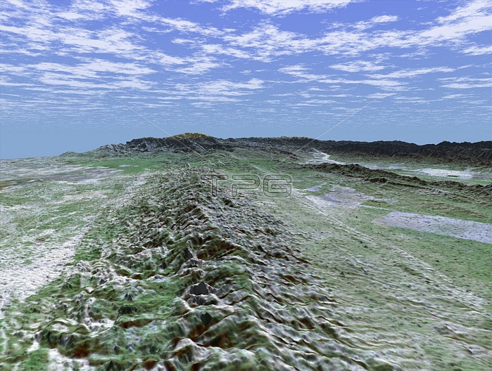
The 800 mile San Andreas is the longest fault in California and one of the longest in North America. This perspective view of a portion of the fault was generated using data from the Shuttle Radar Topography Mission (SRTM), which flew on NASA's Space Shuttle, and an enhanced, true-color Landsat satellite image. For visualization purposes, topographic heights displayed in this image are exaggerated two times. The elevation data used in this image was acquired by SRTM aboard the Space Shuttle Endeavour, launched on February 11, 2000. SRTM used the same radar instrument that comprised the Spaceborne Imaging Radar-C/X-Band Synthetic Aperture Radar (SIR-C/X-SAR) that flew twice on Endeavour in 1994. SRTM was designed to collect three-dimensional measurements of Earth's land surface. To collect the 3-D SRTM data, engineers added a mast about 200 feet long, installed additional C-band and X-band antennas, and improved tracking and navigation devices. Date Acquired: February 16, 2000 (SRTM) December 14, 1984 (Landsat).
| px | px | dpi | = | cm | x | cm | = | MB |
Details
Creative#:
TOP22317318
Source:
達志影像
Authorization Type:
RM
Release Information:
須由TPG 完整授權
Model Release:
N/A
Property Release:
No
Right to Privacy:
No
Same folder images:
 Loading