
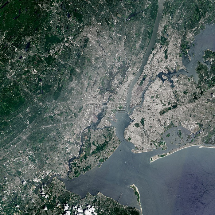
New York City metro area, including all five boroughs and the New Jersey suburbs, as seen by the Operational Land Imager (OLI) on the Landsat 8 satellite, October 25, 2015. Also visible is Sandy Hook, a sand spit and part of Gateway National Recreation Area.
| px | px | dpi | = | cm | x | cm | = | MB |
Details
Creative#:
TOP22317713
Source:
達志影像
Authorization Type:
RM
Release Information:
須由TPG 完整授權
Model Release:
N/A
Property Release:
No
Right to Privacy:
No
Same folder images:
metropolitanareadevelopmentdevelopedurbanizationeastcoastjamaicabayhudsonrivernewarkbaygatewaynationalrecreationareashorelineshorecoastlinecoast2015imageryobservationearthfromspaceearthscienceurbanlandscapelandformgeographicalgeographicgeographygeologicformationgeologyoperationallandimagerolilandsat8newyorkharborsandspitspitsandyhookstatenislandbronxqueensbrooklynlongislandnewjerseymanhattancitymetroareanorthamericaamericanunitedstatesusausaerialviewsatelliteimagelandsatnycnewyorkcitynewyork
82015aerialamericaamericanareaareaareabaybaybronxbrooklyncitycitycoastcoastcoastlinedevelopeddevelopmenteartheartheastformationfromgatewaygeographicgeographicalgeographygeologicgeologyharborhookhudsonimageimagerimageryislandislandjamaicajerseylandlandformlandsatlandsatlandscapelongmanhattanmetrometropolitannationalnewnewnewnewnewarknorthnycobservationolioperationalqueensrecreationriversandsandysatellitescienceshoreshorelinespacespitspitstatenstatesunitedurbanurbanizationususaviewyorkyorkyork
 Loading