
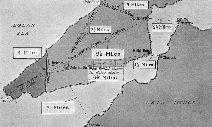
Map showing the distances separating the vital points in the Gallipoli Peninsula. The area held by the Allies is shown in a darker tone, and the position of the Australians at Gaba Tepe is also indicated.
| px | px | dpi | = | cm | x | cm | = | MB |
Details
Creative#:
TOP23959540
Source:
達志影像
Authorization Type:
RM
Release Information:
須由TPG 完整授權
Model Release:
No
Property Release:
No
Right to Privacy:
No
Same folder images:
 Loading