
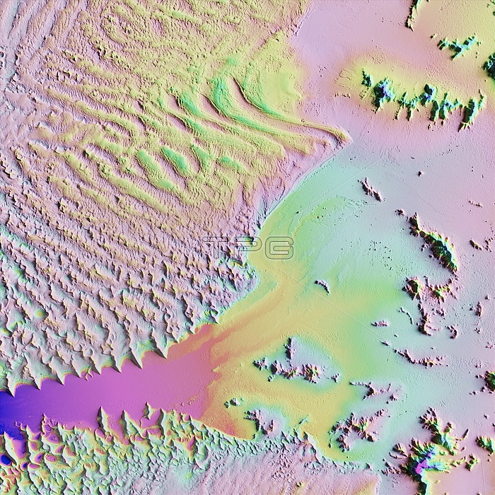
Sand dunes in the Namib Desert, LiDAR satellite image. The desert sands here are piled up high by coastal winds (from left) to form the world's tallest sand dunes (ripples). The dunes can reach 300 metres in height. This is a region of the Namib Desert in Namibia designated the Namib-Naukluft National Park. The Sossusvlei clay pan (lower centre) was eroded and deposited by rare heavy rains that run off the high ground to the right. LiDAR combines optical and laser imaging to produce digital elevation maps (DEMs), with differences in elevation shown by the colour-coding of the image. Image data obtained by the radar and optical sensors on the Advanced Land Observation Satellite (ALOS) of the Japan Aerospace Exploration Agency (JAXA).
| px | px | dpi | = | cm | x | cm | = | MB |
Details
Creative#:
TOP25469170
Source:
達志影像
Authorization Type:
RM
Release Information:
須由TPG 完整授權
Model Release:
N/A
Property Release:
N/A
Right to Privacy:
No
Same folder images:
 Loading