
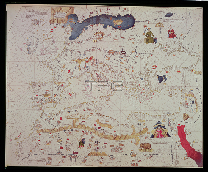
RGS33895 Reproduction of the map of Europe and Mediterranean, from the \'Portolan of Frederici d\'Ancore\', 1497, from the \'Atlas of Mappaemundi and Portolans\', by Vicomte de Santarem, pub. 1842-53 (coloured engraving) by French School, (19th century); Royal Geographical Society, London, UK; 穢 Royal Geographical Society ; French, out of copyright.
| px | px | dpi | = | cm | x | cm | = | MB |
Details
Creative#:
TOP26841675
Source:
達志影像
Authorization Type:
RM
Release Information:
須由TPG 完整授權
Model Release:
No
Property Release:
No
Right to Privacy:
No
Same folder images:
 Loading