
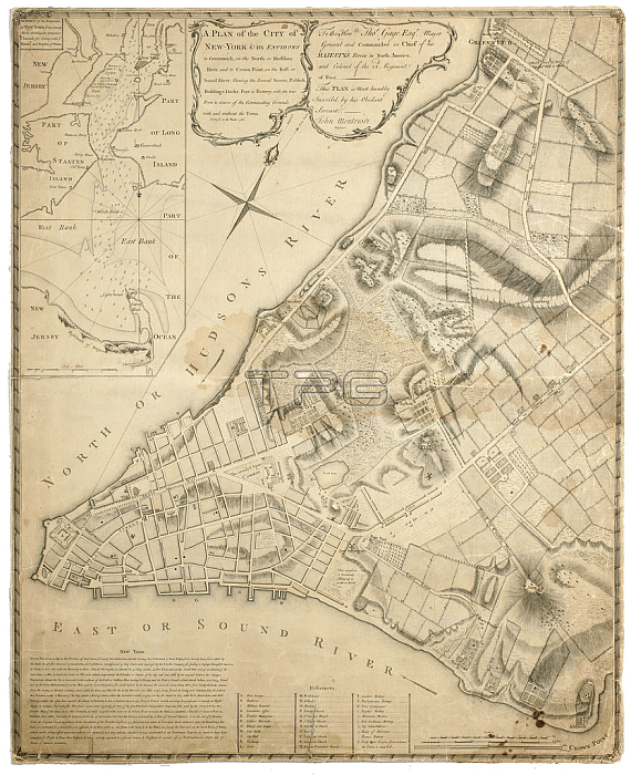
1079214 A Plan of the City of New York and its environs to Greenwich on the North (Hudson) River to Crown Point on the East River, surveyed 1766, 1775 (lithograph) by Montresor, John (1736-99); 65x53 cm; Collection of the New-York Historical Society, USA; (add.info.: A Plan of the City of New York and its Environs to Greenwich on the North River to Crown Point on the East River, surveyed 1766, lithograph, by John Montresor, London, 1775. ); 穢 New York Historical Society ; English, out of copyright.
| px | px | dpi | = | cm | x | cm | = | MB |
Details
Creative#:
TOP27346265
Source:
達志影像
Authorization Type:
RM
Release Information:
須由TPG 完整授權
Model Release:
No
Property Release:
No
Right to Privacy:
No
Same folder images:
 Loading