
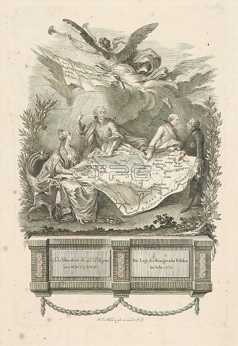
Map of Poland divided between the princes, 1773, La situation de la Pologne en MDCCLXXIII / Die Lage des Konigreichs Pohlen im Iahr 1773 (title on object), Cartoon of 1773 on the division of Poland by Frederick the Great of Prussia, Joseph II of Austria, Stanislaus II of Poland and Catherine the Great of Russia. Fama blows two trumpets in the air. The treaty that led to the First Polish Partition was concluded on February 17, 1772. Implementation officially began on August 5, 1772. Copy to the original by Lemire. print maker: Johann Esaias Nilson, (mentioned on object), publisher: Johann Esaias Nilson, (mentioned on object), after print by: Noel Le Mire, Augsburg, 1773, paper, etching, engraving, height 291 mm x width 193 mm.
| px | px | dpi | = | cm | x | cm | = | MB |
Details
Creative#:
TOP28937526
Source:
達志影像
Authorization Type:
RM
Release Information:
須由TPG 完整授權
Model Release:
No
Property Release:
No
Right to Privacy:
No
Same folder images:
 Loading