
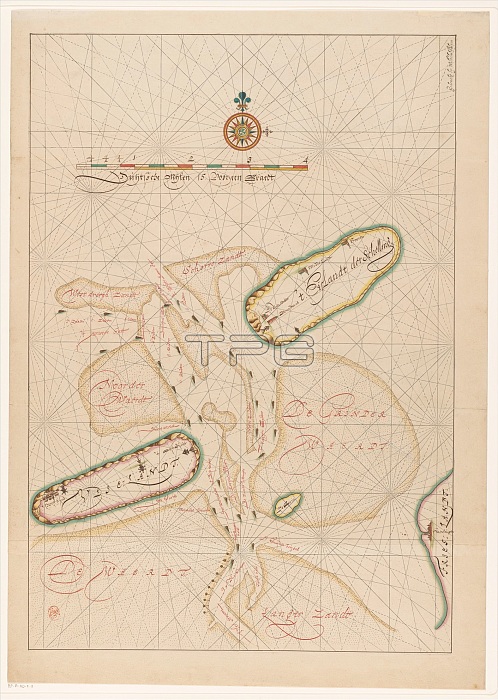
Vlieland map, Terschelling, part of Friesland and the surrounding sandbanks, c.1620-c.1699. Creator: Anon.
| px | px | dpi | = | cm | x | cm | = | MB |
Details
Creative#:
TOP29406709
Source:
達志影像
Authorization Type:
RM
Release Information:
須由TPG 完整授權
Model Release:
Not Required
Property Release:
Not Required
Right to Privacy:
No
Same folder images:
EuropehistoricalartsmapsandartmuseumNetherlandsDutchcolorscenedepictionlocationdrawinggalleryinkprintsandycartographyartefactconceptexhibitionexhibitartifactwatercolourillustratedengravedengravingartgalleryColoursandbankSANDBANKSNetherlandishculturehistoryhistoricmap-makingRijksmuseumTGNillustrationinkMapmakingAnonAnonymousFrieslandwatercolouronpaperartcentreTerschellingpaperHeritageArtPrintDrawingLowCountrieswatercolour(paint)Vlieland
(paint)AnonAnonymousArtColourCountriesDrawingDutchEuropeFrieslandHeritageLowMapmakingNetherlandishNetherlandsPrintRijksmuseumSANDBANKSTGNTerschellingVlielandartartartartefactartifactartscartographycentrecolorconceptculturedepictiondrawingengravedengravingexhibitexhibitiongallerygalleryhistorichistoricalhistoryillustratedillustrationinkinklocationmapmap-makingmuseumonpaperpaperprintsandsandbanksandyscenewatercolourwatercolourwatercolour
 Loading