
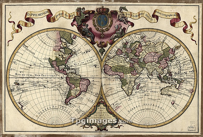
18th century map of the world. Published in Paris in 1720, this French map shows the known world, including the new lands that had been discovered in the preceding centuries by Europeans exploring across the Atlantic and far to the East around Africa. It divides the Earth into a western and eastern hemisphere, and uses colour to mark different areas of land. The map is by Guillaume de l'Isle (1675-1726), the leading French cartographer of the eighteenth century. He was appointed Premier Geographe du Roi to King Louis XV in 1718. This edition of his world map includes the western and northern coastlines of Australia, mapped by the Dutch. Australia's eastern coastline would not be mapped until 1770.
| px | px | dpi | = | cm | x | cm | = | MB |
Details
Creative#:
TPG05323651
Source:
達志影像
Authorization Type:
RF
Release Information:
須由TPG 完整授權
Model Release:
NO
Property Release:
NO
Right to Privacy:
No
Same folder images:
 Loading