
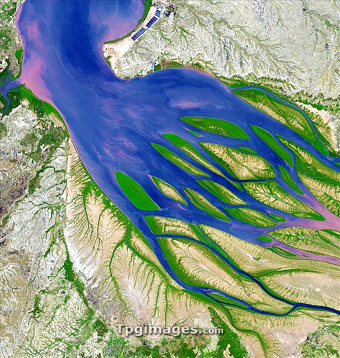
Bombetoka Bay, Madagascar, satellite image. This bay links the Betsiboka River (at right) with the Mozambique Channel (top left), part of the Indian Ocean. The river carries a large amount of sediment, which has led to the development of several silt islands. The edges of these are green as they have been colonised by mangroves. The heavy sediment load is largely due to deforestation along the river's banks to make way for agriculture. Crops including rice and coffee are extensively grown in the area. This image, which is around 30 kilometres square, was taken by the ASTER instrument on the Terra satellite.
| px | px | dpi | = | cm | x | cm | = | MB |
Details
Creative#:
TPG05323704
Source:
達志影像
Authorization Type:
RF
Release Information:
須由TPG 完整授權
Model Release:
NO
Property Release:
NO
Right to Privacy:
No
Same folder images:
 Loading