
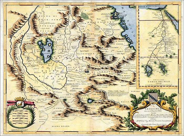
A Venetian cartographer, Coronelli (1650-1718) cites his sources for this Nile map, including the Portuguese Jesuits Pedro P獺ez and Jer籀nimo Lobo, and contrasts his work with an inset showing the ???riginal??(that is, outdated) course of the Nile as presented by past geographers, who followed the Ptolemaic tradition of two source lakes.
P獺ez and Lobo had visited Ethiopia in the early 1600s, and both gave accounts of having seen the springs that natives believed to be the river??? source, though the Jesuits failed to distinguish between the two branches of the river. Coronelli??? Nile is the Blue Nile, and his geography is fairly accurate for that branch, identifying the significance of Lake Tsana and the clockwise unfolding of the river as it descends from there.
| px | px | dpi | = | cm | x | cm | = | MB |
Details
Creative#:
TPG32688910
Source:
達志影像
Authorization Type:
RF
Release Information:
須由TPG 完整授權
Model Release:
No
Property Release:
No
Right to Privacy:
No
Same folder images:
 Loading