
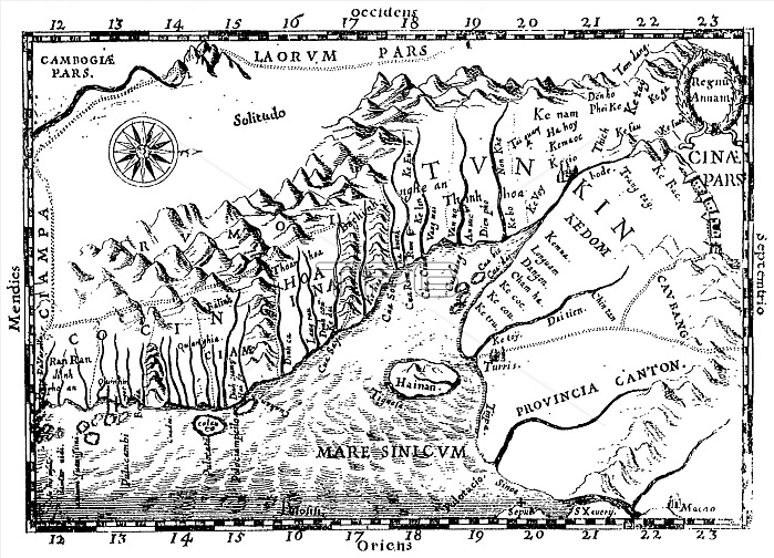
One of the earliest Western maps showing details of northern and central Vietnam appeared in Father Alexander de Rhodes' 'Histoire du royaume de Tunquin', published in Rome in 1650.
This map is from the French edition, published a year later in Lyon. Oriented with the north to the right, 'Regnu Annam' shows the extent of seventeenth-century Vietnam, then divided between two rival dynasties, one in the north and the other in central Vietnam. Remnants of the Cham kingdom, eventually destroyed by the Vietnamese, still exist in the south.
To the west, are the highlands occupied by 'Rumoi' (upland minority groups, later called "montagnards" by the French). The limited Western knowledge of the interior is illustrated by the large region labeled 'Solitudo'.
| px | px | dpi | = | cm | x | cm | = | MB |
Details
Creative#:
TPG32689887
Source:
達志影像
Authorization Type:
RF
Release Information:
須由TPG 完整授權
Model Release:
No
Property Release:
No
Right to Privacy:
No
Same folder images:
 Loading