
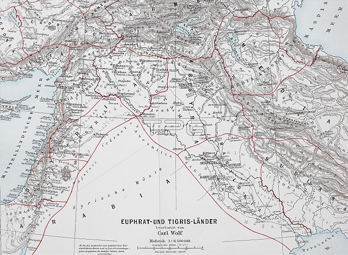
Map of the countries around Euphrates and Tigris from ca 1870, Babylonia, Arabia, Syria, Historic, digitally restored reproduction of an original from the 19th century, exact original date not known, Asia
| px | px | dpi | = | cm | x | cm | = | MB |
Details
Creative#:
TPG33515169
Source:
達志影像
Authorization Type:
RF
Release Information:
須由TPG 完整授權
Model Release:
No
Property Release:
No
Right to Privacy:
No
Same folder images:
1st119th-century19thcentury18701900saccurateArabianPeninsulaArabianArabiaArabicArabartsartworksartworkartworkartAsiablack-and-whiteblack-whiteblackandwhiteblackcopycountriescountrydepictionsdepictiondeserteddigitallydigitaldrawingsdrawingdrawnemptyexactgeographicalgeographicgeographyillustrationsillustrationimagemotifimagemapsmapMiddleEastMideastMidEastmotifNearEastnineteenthcenturynobodynooneNoPeopleoldoneOriginaldatephotographicreproductionsphotographicreproductionprecisereconstructionrefurbishmentreplicationreplicarepresentationreproductionrestorationsrestorationworkrestorationrestoredriversriversketchSouthwestAsiaSouthwesternAsiastoriesstorySyrianArabRepublicSyrianRepublicSyrianSyriataleTigrisuninhabitedvintageWestAsiaWesternAsiawhitewoodcutswoodcutwoodprintworkofartxylograph
118701900s19th19th-century1stArabArabArabiaArabianArabianArabicAsiaAsiaAsiaAsiaAsiaEastEastEastMidMiddleMideastNearNoOriginalPeninsulaPeopleRepublicRepublicSouthwestSouthwesternSyriaSyrianSyrianSyrianTigrisWestWesternaccurateandartartartartsartworkartworksblackblackblack-and-whiteblack-whitecenturycenturycopycountriescountrydatedepictiondepictionsdeserteddigitaldigitallydrawingdrawingsdrawnemptyexactgeographicgeographicalgeographyillustrationillustrationsimageimagemapmapsmotifmotifnineteenthnonobodyofoldoneonephotographicphotographicprecisereconstructionrefurbishmentreplicareplicationrepresentationreproductionreproductionreproductionsrestorationrestorationrestorationsrestoredriverriverssketchstoriesstorytaleuninhabitedvintagewhitewhitewoodcutwoodcutswoodprintworkworkworkxylograph
 Loading