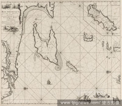
EditorialPass card of the Gulf of Paria with the mouth of the Orinoco river Pass card of Rio Oronoque Golfo De Paria. with d''ey countries Trinidad, Tabago, Granada, Granadillos, and Bequia (title on object), Passport card of the Gulf of Paria with the mouth of...
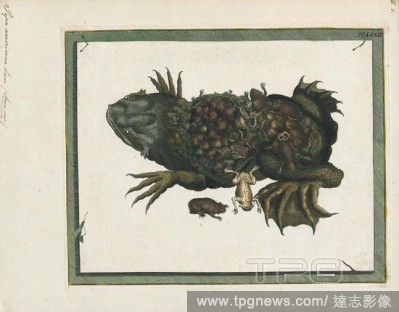
EditorialPipa americana, Print, The common Suriname toad or star-fingered toad (Pipa pipa) is a species of frog in the family Pipidae found in Bolivia, Brazil, Colombia, Ecuador, French Guiana, Guyana, Peru, Suriname, Trinidad and Tobago, and Venezuela. In Span...
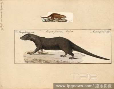
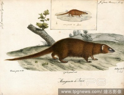
EditorialHerpestes javanicus, Print, The Javan mongoose (Herpestes javanicus) is a species of mongoose found in the wild in South and Southeast Asia. It has also been introduced to Hawaii, the Bahamas, Cuba, Croatia, Jamaica, Hispaniola, Puerto Rico, the Lesser...
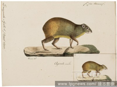
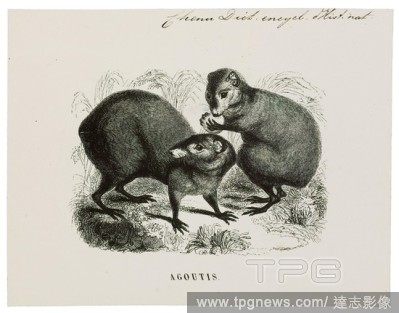
EditorialDasyprocta aguti, Print, The red-rumped agouti (Dasyprocta leporina), also known as the golden-rumped agouti, orange-rumped agouti or Brazilian agouti, is a species of agouti from the family Dasyproctidae. It is native to northeastern South America, wh...
EditorialHerpestes javanicus, Print, The Javan mongoose (Herpestes javanicus) is a species of mongoose found in the wild in South and Southeast Asia. It has also been introduced to Hawaii, the Bahamas, Cuba, Croatia, Jamaica, Hispaniola, Puerto Rico, the Lesser...
EditorialDasyprocta aguti, Print, The red-rumped agouti (Dasyprocta leporina), also known as the golden-rumped agouti, orange-rumped agouti or Brazilian agouti, is a species of agouti from the family Dasyproctidae. It is native to northeastern South America, wh...
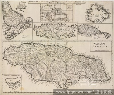
EditorialA map of the English Empire in the Ocean of America, or the West Indies. A new Map of the English Empire in the Ocean of America, or the West Indies (the Islands of Jamaica, Barbadoes, Bermudas, Tobago, St. Christopher's, and Antigua). London : Chr. Br...
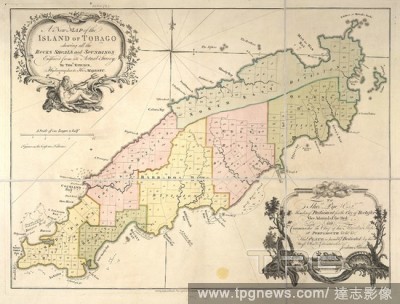
EditorialTobago. A New Map of the Island of Tobago ... Engraved fro. London : J. Rhodes & T. Kitchin, [1760]. Source: Maps.*82510.(8),. Language: English.
EditorialTobago. [The Island of Tobago. By J. Seller, etc. (A Chart. [1688]. Map of the island of Tobago. Image taken from [The Island of Tobago. By J. Seller, etc. (A Chart of the Carriby Islands.) A scale of Miles, 10[ = 165 mm]]. Originally published/produ...


 Loading