
filter
-
Brand
- By Category
- Direction
- Date Range
461Events
Pictures
Events

Editorial EXCLUSIVE: New London property development asks buyers for just ?4,094 in deposit ? but there's a catch
- 2024-06-11
- 8

Editorial 'Suicide pods' approved for use in Switzerland
- 2021-12-08
- 9
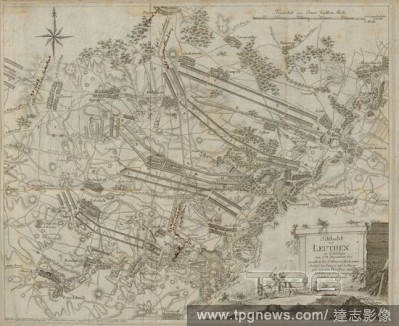
Editorial Battle of Leuthen in Silesia ..., Plan for the Battle of Leuthen on December 5, 1757, signed: After a precise survey of the terrain of new made by C. L. Oesfeld; engraved by C. C. Glassbach sen, 8th leaf, after p. 342, Oesfeld, Carl Ludwig von (angefer...
- 2020-01-15
- 1
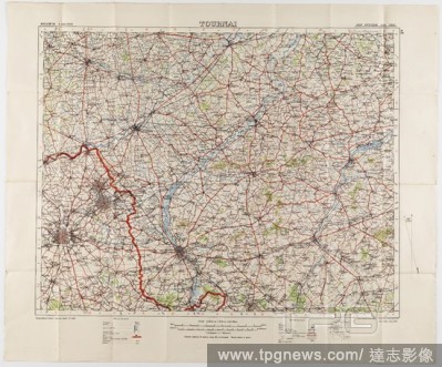
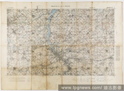
Editorial Maps - Military, Belgium, Tournai, Scale 1:100,000, 1912, Two large folded maps, identical content, titled 'Tournai 5', Belgium, scale 1/100,000. They were printed for the Geographical Staff, General Staff, number 2364, and were 'Photo-etched at the Or...
- 2020-01-15
- 1
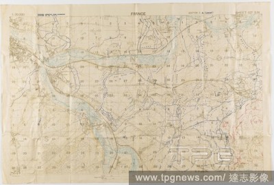
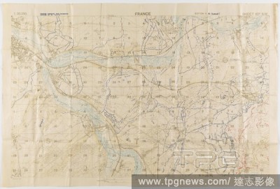
Editorial Map - Military, Trench, France, Sheet 62D SW, Scale 1:20,000, Edition 3A, World War I, 18 Jun 1918, One of two copies of a military trench map, France, sheet 62 D. S. W., edition 3.A., (local) scale 1:20,000. Trenches corrected from information receive...
- 2020-01-15
- 1
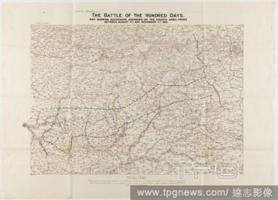
Editorial Map - France, 'Battle of the Hundred Days', Scale 1:250,000, World War I, Aug-Nov 1918, Field survey map of France, scale 1:250,000, titled 'The Battle of the Hundred Days', showing the successive advances on the Fourth Army front between 8 August and ...
- 2020-01-15
- 1
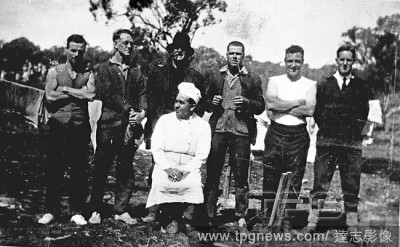
Editorial Negative - Casterton District, Victoria, 1929, Workmen at the railway survey camp for the proposed Casterton to Narracoorte railway. The camp was in the Barr Road Reserve, five miles from Casterton. The cook is sitting in the middle of the front row.
- 2020-01-15
- 1

Editorial Negative - Gipsy's Valley, Victoria, 1902, Surveyors of a Lands Development survey party in camp.
- 2020-01-15
- 1

Editorial Map - Military, Belgium, Antwerp 3, Scale 1:100,000, 1912, Military map, Belgium, Antwerp, 3 scale 1:100,000. Labelled 'Georgaphical Section General Staff no. 2364', the map was photo-etched at the Ordnance Survey Office, Southampton, England, in 1911,...
- 2020-01-15
- 1
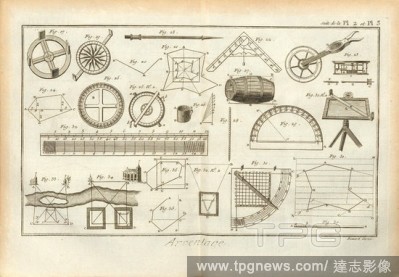
Editorial Survey 2, Instruments and calculations for surveying, Signed: Benard Direx, Suite de la Pl. 2 et Pl. 3, p. 14, Benard (dir.), Denis Diderot; M. d'Alembert: Encyclop?die, ou dictionnaire raisonn? des sciences, des arts et des m?tierss, des arts et des m...
- 2020-01-15
- 1
Editorial Map - Military, Trench, France, Sheet 62D SW, Scale 1:20,000, Edition 3A, World War I, 18 Jun 1918, One of two copies of a military trench map, France, sheet 62 D. S. W., edition 3.A., (local) scale 1:20,000. Trenches corrected from information receive...
- 2020-01-15
- 1
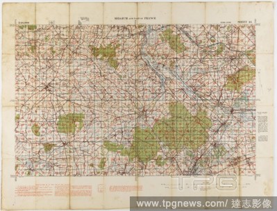
Editorial Map - Military, Belgium & France, Sheet 44, Scale 1:40,000, Edition 3, 1915, World War I map of Belgium and France, sheet 44, edition 3, 1:40,000. It was printed by (or for) the Ordnance Survey Office, and is dated 1915.
- 2020-01-15
- 1
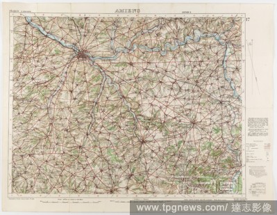
Editorial Map - Military, France, Amiens 17, Scale 1:100,000, Edition 2, World War I, 1 Oct 1916, World War I military map of Amiens, Sheet 17, France, scale 1:100,000, edition 2, published by the War Office in October 1915 from a 1915 Ordnance Survey, with 'min...
- 2020-01-15
- 1
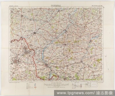
Editorial Map - Military, Belgium, Tournai 5, Scale 1:100,000, World War I, Jul 1912, Map of Belgium - Sheet Tournai, 5, scale 1:100,000. The map was photo-etched at the Ordnance Survey Office, Southampton, in 1912, and was published by the War Office, July 1912...
- 2020-01-15
- 1
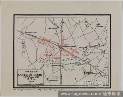
Editorial Map - Battle of Quatre Bras, Waterloo Campaign, 16 Jun 1815, 5th Field Survey, 8 Feb 1919, Map depicting the Battle of Quatre Bras, 16 June 1815. It was fought two days before the Battle of Waterloo. Part of a set of information about the Waterloo Camp...
- 2020-01-15
- 1
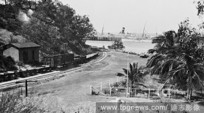
Editorial Negative - Darwin, Northern Territory, circa 1935, The SS Marella at the Darwin Harbour main jetty, the Australian Navy survey ship HMAS Moresby is on the near side of the jetty. The photograph was taken from near Fort Hill looking down a road towards ...
- 2020-01-15
- 1
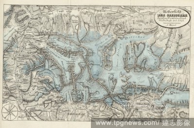
Editorial Overview of the glaciers between Grindelwald and Valais, Hasle and L?tsch, Illustration of the survey of glaciers between Grindelwald and Valais, Hasli and L?tschental from the 19th century, pl., XVIII, after p. 378, 1830, Franz Joseph Hugi: Naturhisto...
- 2020-01-15
- 1

Editorial Filled eruption column on the crater plateau of Vesuvius, ..., Fig. 1: Illustration of a filled eruption column on the crater plateau of Vesuvius from the 19th century, Fig. 2: Illustration of a survey column from the 19th century, Fig. 3: Illustration...
- 2020-01-15
- 1
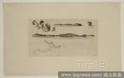
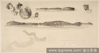
Editorial James Abbott McNeill Whistler, American, 1834-1903, Sketches on the Coast Survey Plate, between 1854 and 1855, etching printed in black ink on laid paper, Plate: 5 3/4 ? 10 1/4 inches (14.6 ? 26 cm).
- 2020-01-15
- 1
Editorial Site survey ... right on Marlapoera river, anonymous, 1910 - 1930.
- 2020-01-15
- 1

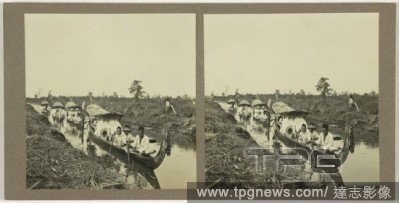
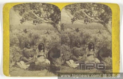
Editorial Utah Ute Indian and Lady "Courting" in N.E. Utah, from the U.S. Topographical and Geological Survey of the Colorado River of the West. Attributed to John K. Hillers; American, born Germany, 1843-1925. Date: 1871-1874. Dimensions: 11 x 7.7 cm (each imag...
- 2019-12-17
- 1

Editorial Arc antique ? Orange.
- 2019-12-17
- 1
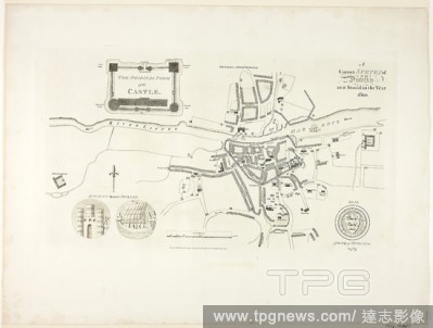
Editorial Correct Survey of Dublin, As It Stood in the Year 1610. James Malton; English, 1761-1803. Date: 1792. Dimensions: 275 ? 475 mm (plate); 420 ? 555 mm (sheet). Aquatint in black on ivory wove paper. Origin: England.
- 2019-12-17
- 1

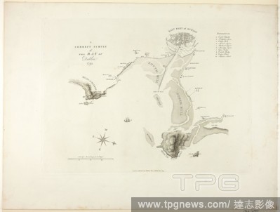
Editorial A Correct Survey of the Bay of Dublin. James Malton; English, 1761-1803. Date: 1795. Dimensions: 315 ? 425 mm (plate); 420 ? 555 mm (sheet). Aquatint in black on ivory wove paper. Origin: England.
- 2019-12-17
- 1

Editorial Sketches on the Coast Survey Plate.
- 2019-12-17
- 1

Editorial Site survey. Marlapoera river [our], anonymous, 1910 - 1930.
- 2019-11-19
- 1
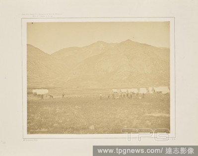
Editorial Camp of the U.S. Geological Survey at Ogden, Utah, William Henry Jackson (American, 1843 - 1942), Washington, District of Columbia, United States, 1873, Albumen silver print, 25.9 ? 33.2 cm (10 3/16 ? 13 1/16 in.).
- 2019-11-19
- 1
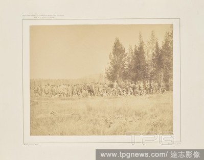
Editorial Meeting of The U.S. Geological Survey in the Lower Firehole Basin, William Henry Jackson (American, 1843 - 1942), Washington, District of Columbia, United States, 1873, Albumen silver print, 25.1 ? 32.2 cm (9 7/8 ? 12 11/16 in.).
- 2019-11-19
- 1
Editorial Utah Ute Indian and Lady "Courting" in N.E. Utah, from the U.S. Topographical and Geological Survey of the Colorado River of the West. Attributed to John K. Hillers; American, born Germany, 1843-1925. Date: 1871-1874. Dimensions: 11 x 7.7 cm (each imag...
- 2019-11-19
- 1

Editorial Correct Survey of Dublin, As It Stood in the Year 1610. James Malton; English, 1761-1803. Date: 1792. Dimensions: 275 ? 475 mm (plate); 420 ? 555 mm (sheet). Aquatint in black on ivory wove paper. Origin: England.
- 2019-11-19
- 1

Editorial A Correct Survey of the Bay of Dublin. James Malton; English, 1761-1803. Date: 1795. Dimensions: 315 ? 425 mm (plate); 420 ? 555 mm (sheet). Aquatint in black on ivory wove paper. Origin: England.
- 2019-11-19
- 1
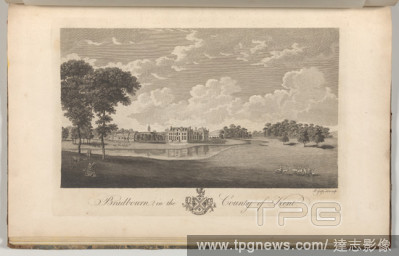
Editorial Bradbourn in the County of Kent, from Edward Hasted's, The History and Topographical Survey of the County of Kent, vols. 1-3.
- 2019-11-18
- 1
Editorial Antiquities Dug up at Different Times in Crock-field near Newington, from Edward Hasted's, The History and Topographical Survey of the County of Kent, vols. 1-3.
- 2019-11-18
- 1
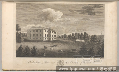
Editorial Beckenham Place in the County of Kent, from Edward Hasted's, The History and Topographical Survey of the County of Kent, vols. 1-3.
- 2019-11-18
- 1
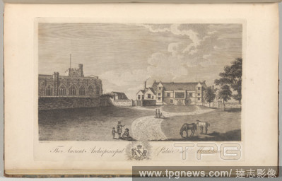
Editorial The Ancient Archiepiscopal Palace at Maidstone, from Edward Hasted's, The History and Topographical Survey of the County of Kent, vols. 1-3.
- 2019-11-18
- 1
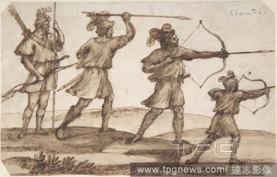
Editorial Three Archers and a Figure with a Spear.
- 2019-11-18
- 1
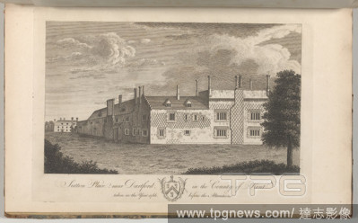
Editorial Sutton Place, near Dartford, in the County of Kent, taken in the year 1766, before the alterations, from Edward Hasted's, The History and Topographical Survey of the County of Kent, vols. 1-3.
- 2019-11-18
- 1
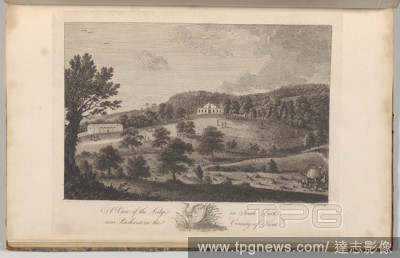
Editorial A View of the Lodge in the South Park, near Penshurst in the County of Kent, from The History and Topographical Survey of the County of Kent, vols. 1-3.
- 2019-11-18
- 1

Editorial Ruins of the Ancient Archiepiscopal Palace at Otford in Kent, from Edward Hasted's, The History and Topographical Survey of the County of Kent, vols. 1-3.
- 2019-11-18
- 1
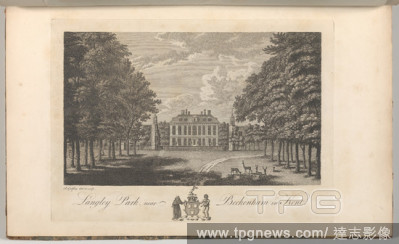
Editorial Langley Park, near Beckenham in Kent, from Edward Hasted's, The History and Topographical Survey of the County of Kent, vols. 1-3.
- 2019-11-18
- 1
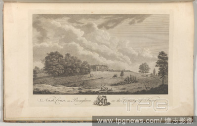
Editorial Nash Court in Boughton, in the County of Kent, from Edward Hasted's, The History and Topographical Survey of the County of Kent, vols. 1-3.
- 2019-11-18
- 1
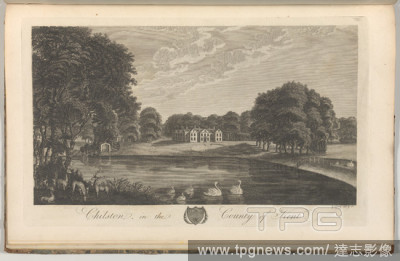
Editorial Chilston in the County of Kent, from Edward Hasted's, The History and Topographical Survey of the County of Kent, vols. 1-3.
- 2019-11-18
- 1
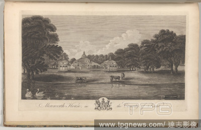
Editorial Merenorth House, in the County of Kent, from Edward Hasted's, The History and Topographical Survey of the County of Kent, vols. 1-3.
- 2019-11-18
- 1
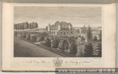
Editorial North Cray Place, in the County of Kent, from Edward Hasted's, The History and Topographical Survey of the County of Kent, vols. 1-3.
- 2019-11-18
- 1
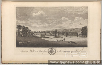
Editorial Preston Hall in Aylesford, in the County of Kent, from Edward Hasted's, The History and Topographical Survey of the County of Kent, vols. 1-3.
- 2019-11-18
- 1
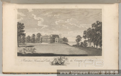
Editorial Belvidere House, near Erith, in the County of Kent, from Edward Hasted's, The History and Topographical Survey of the County of Kent, vols. 1-3.
- 2019-11-18
- 1
Editorial Somerhill, near Tunbridge, in the County of Kent, from Edward Hasted's, The History and Topographical Survey of the County of Kent, vols. 1-3.
- 2019-11-18
- 1

Editorial Two Female Heads and Standing Figure (from Sketches on the Coast Survey Plate).
- 2019-11-18
- 1
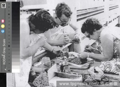
Editorial Digital Image - Hope Macpherson & Dan Lynch Sorting Material on the Jetty at Quarantine Station, Port Phillip Survey, Victoria, 1959, Digital image depicting Hope Macpherson, Curator of Molluscs at National Museum of Victoria, and Dan Lynch, Fisheries ...
- 2019-11-18
- 1

Editorial Map - Military, Trench, France, Sheet 62D SW, Scale 1:20,000, Edition 3A, World War I, 18 Jun 1918, One of two copies of a military trench map, France, sheet 62 D. S. W., edition 3.A., (local) scale 1:20,000. Trenches corrected from information receive...
- 2019-11-18
- 1

Editorial Negative - Daylesford Distict, Victoria, 1874, The survey team for the Castlemaine to Daylesford railway line at their camp.
- 2019-11-18
- 1

Editorial Negative - Casterton District, Victoria, 1929, A railway survey camp for the proposed Casterton to Narracoorte railway. The camp was in the Barr Road Reserve, five miles from Casterton. There is a Furphy water cart on the left.
- 2019-11-18
- 1
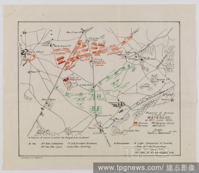
Editorial Map - Position of Armies in Front of Waterloo, 18 Jun 1815, Field Survey 25 Jan 1919, Map depicting the position of armies in front of Waterloo on 18 June 1815. Part of a set of information about the Waterloo Campaign, 1815, comprising three maps, two ...
- 2019-11-18
- 1

Editorial Map - Military, Trench, France, Jeancourt Sector, Scale 1:20,000, With Trace Overlay, World War I, 14 Sep 1918, Trench map of Jeancourt Sector with trace overlay, scale 1:20,000, made and used during World War I. It is dated 14 September 1918, and is i...
- 2019-11-18
- 1
Editorial Map - Military, Belgium & France, Sheet 37, Scale 1:40,000, Edition 3, Mar 1917, Map of Belgium and part of France, Ordnance Survey Sheet 37, Scale 1:40,000, Edition 3, March 1917. The back of the map provides common military-related French words and t...
- 2019-11-18
- 1
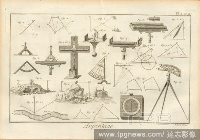
Editorial Survey 1, Instruments and calculations for surveying, Signed: Benard Direx, Pl. 1 et 2, p. 14, Benard (dir.), Denis Diderot; M. d'Alembert: Encyclop?die, ou dictionnaire raisonn? des sciences, des arts et des m?tierss, des arts et des m?tiers. Gen?ve: ...
- 2019-11-18
- 1
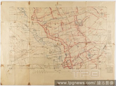
Editorial Map - Military, Trench, France, Douve, Sheet 28, Scale 1:5,000, World War I, May 1917, Alternative Name(s): Military Map Ordnance Survey trench map, Douve, France, World War I, dated May 1917. Part of sheet 28. Scale 1:5,000. Trenches corrected to 1:4:...
- 2019-11-18
- 1
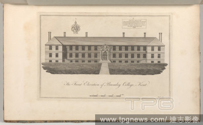
Editorial The Front Elevation of Bromley College, Kent, from Edward Hasted's, The History and Topographical Survey of the County of Kent, vols. 1-3.
- 2019-11-18
- 1

Editorial The Diwan-i Khas from the Mussaman Burj, Agra Palace.
- 2019-11-18
- 1
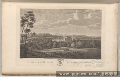
Editorial Hever Castle in the County of Kent, from Edward Hasted's, The History and Topographical Survey of the County of Kent, vols. 1-3.
- 2019-11-18
- 1

Editorial Tunbridge Castle in the County of Kent, from Edward Hasted's, The History and Topographical Survey of the County of Kent, vols. 1-3.
- 2019-11-18
- 1
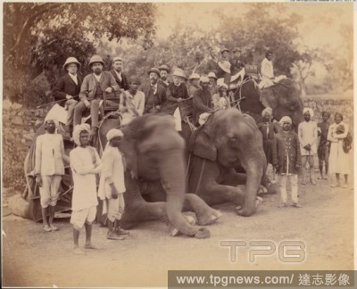
Editorial Elephant Group.
- 2019-11-18
- 1
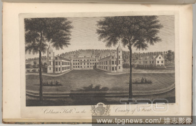
Editorial Cobham Hall in the County of Kent, from The History and Topographical Survey of the County of Kent, vols. 1-3.
- 2019-11-18
- 2
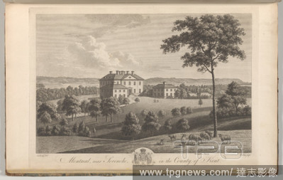
Editorial Montreal, near Sevenoke, in the County of Kent, from Edward Hasted's, The History and Topographical Survey of the County of Kent, vols. 1-3.
- 2019-11-18
- 1
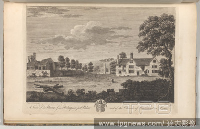
Editorial A View of the Ruins of the Archiepiscopal Palace and of the Church of Wrotham in Kent, from Edward Hasted's, The History and Topographical Survey of the County of Kent, vols. 1-3.
- 2019-11-18
- 1

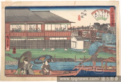
Editorial The Ono at Ryogoku Yanagibashi.
- 2019-11-18
- 1
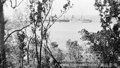
Editorial Negative - Darwin, Northern Territory, circa 1935, The SS Marella at the Darwin Harbour main jetty, the Australian Navy survey ship HMAS Moresby is on the near side of the jetty.
- 2019-11-18
- 1

Editorial Arc antique ? Orange.
- 2019-11-18
- 1

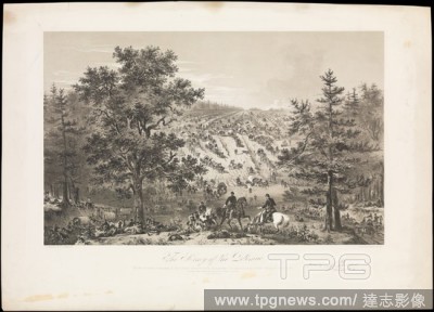
Editorial The Army of the Potomac.
- 2019-10-28
- 1

Editorial The Town on the Hill, New Almaden.
- 2019-10-28
- 1

Editorial Sketches on the Coast Survey Plate.
- 2019-10-28
- 1
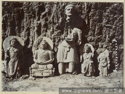
Editorial Sahri-Bahlol, Mound S.C. Statue of a male worshipper, one seated Buddha, and three standing Bodhisattva figures, north-east. 1911-12. Photograph. Source: Photo 1006/2(1130).
- 2019-07-16
- 1

Editorial Sukkar, Sukkar District. Mosam Shah's Mosque and minar, view from south-west. Archaeological Survey of India Collections: Western India 1915-17. 1915-16. Source: Photo 1009/15(4461).
- 2019-07-16
- 1
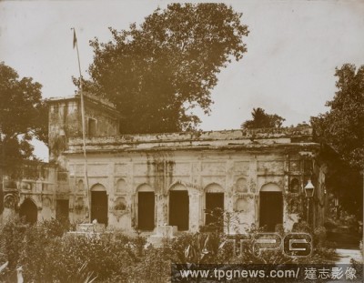
Editorial Photo of Sikh temple at Dacca in India. Archaeological Survey of India Collections: Eastern Circle (New Series), 1920-21. 1920-21. Source: Photo 1005/5/(30). Language: English.
- 2019-07-16
- 1
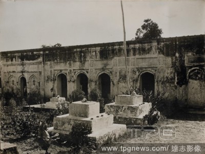
Editorial Dacca. Sikh temple, from North-East. Archaeological Survey of India 1920-21. 1920-21. Source: Photo 1005/5(31). Language: English.
- 2019-07-09
- 1
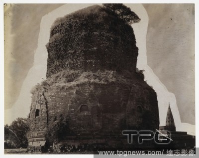
Editorial A general view of the Dhamekh Stupa at Sarnath. Archaeological Survey of India Collections: Indian Museum Series (Duplicates). 1870s. Photograph. Source: Photo 1003/(673).
- 2019-07-09
- 1

Editorial Peshawar. Kanishka casket, crystal reliquary with Buddha's relics, sealing and a coin. Archaeological Survey of India Collections: Director General's Report, 1909-10. 1909-10. Photograph. Source: Photo 1010/8(292).
- 2019-07-09
- 1
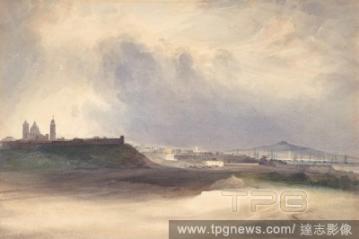
Editorial Approach to Montevideo, Uruguay, 1832, Watercolor over graphite, sheet: 7 13/16 x 11 11/16 in. (19.8 x 29.7 cm), Drawings, Conrad Martens (British, London 1801?1878 Sydney), Martens made this drawing at Montevideo, where he accepted a two-year position...
- 2019-07-09
- 1

Editorial Arc antique ? Orange.
- 2019-04-16
- 1
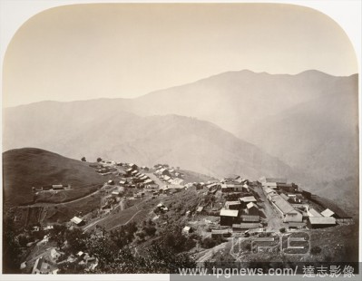
Editorial The Town on the Hill, New Almaden.
- 2019-04-16
- 1
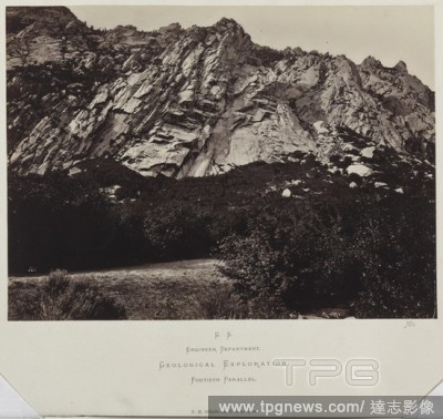
Editorial King Survey (series from a geographical survey of the 40th parallel): East Humboldt Mountains, Utah, 1868. Timothy H. O'Sullivan (American, 1840-1882). Albumen print from wet collodion negative; image: 19.7 x 27 cm (7 3/4 x 10 5/8 in.); matted: 40.6 x ...
- 2019-04-01
- 1

Editorial Utah Ute Indian and Lady "Courting" in N.E. Utah, from the U.S. Topographical and Geological Survey of the Colorado River of the West. Attributed to John K. Hillers; American, born Germany, 1843-1925. Date: 1871-1874. Dimensions: 11 x 7.7 cm (each imag...
- 2019-04-01
- 1

Editorial A Correct Survey of the Bay of Dublin. James Malton; English, 1761-1803. Date: 1795. Dimensions: 315 ? 425 mm (plate); 420 ? 555 mm (sheet). Aquatint in black on ivory wove paper. Origin: England.
- 2019-04-01
- 1
Editorial Sketches on the Coast Survey Plate.
- 2019-04-01
- 1

Editorial Utah Ute Indian and Lady "Courting" in N.E. Utah, from the U.S. Topographical and Geological Survey of the Colorado River of the West. Attributed to John K. Hillers; American, born Germany, 1843-1925. Date: 1871-1874. Dimensions: 11 x 7.7 cm (each imag...
- 2019-03-18
- 1

Editorial Correct Survey of Dublin, As It Stood in the Year 1610. James Malton; English, 1761-1803. Date: 1792. Dimensions: 275 ? 475 mm (plate); 420 ? 555 mm (sheet). Aquatint in black on ivory wove paper. Origin: England.
- 2019-03-11
- 1
Editorial A Correct Survey of the Bay of Dublin. James Malton; English, 1761-1803. Date: 1795. Dimensions: 315 ? 425 mm (plate); 420 ? 555 mm (sheet). Aquatint in black on ivory wove paper. Origin: England.
- 2019-03-11
- 1

Editorial Three Archers and a Figure with a Spear.
- 2019-02-22
- 1
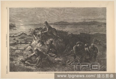
Editorial A Night Scout in the Southwest-Surprise of an Outpost, and Survey of the Rebel Guns (from Harper's Weekly).
- 2019-02-22
- 1
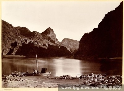
Editorial Black Ca?on, From Camp 8, Looking Above.
- 2019-02-22
- 1

Editorial The Town on the Hill, New Almaden.
- 2019-02-22
- 1

Editorial Two Female Heads and Standing Figure (from Sketches on the Coast Survey Plate).
- 2019-02-22
- 1

Editorial Sketches on the Coast Survey Plate.
- 2019-02-22
- 1
Editorial The Army of the Potomac.
- 2019-02-15
- 1

Editorial Elephant Group.
- 2019-02-15
- 1
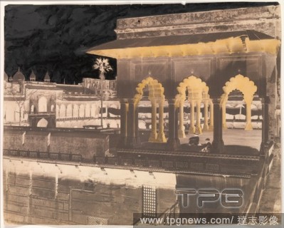
Editorial The Diwan-i Khas from the Mussaman Burj, Agra Palace.
- 2019-02-15
- 1

Editorial A Plan of the City of New York from an Actual Survey Made by James Lyne, 1728.
- 2019-02-15
- 1
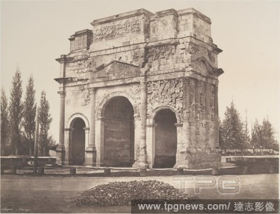
Editorial Arc antique ? Orange.
- 2019-02-11
- 1

Editorial Sketches on the Coast Survey Plate.
- 2019-02-01
- 1
Editorial The Ono at Ryogoku Yanagibashi.
- 2019-02-01
- 1
 Loading