
filter
-
Brand
- By Category
- Direction
- Date Range
113Events
Pictures
Events

Editorial
- 2023-03-29
- 24

Editorial Portrait of Shaoyu in the Guise of Liu Ling.
- 2020-03-02
- 1

Editorial Krishna and Balarama within a Walled Palace: Page from a Dispersed Bhagavata Purana (Ancient Stories of Lord Vishnu).
- 2020-03-02
- 1

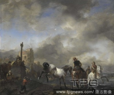
Editorial Watering Horses near a Boundary Marker. Dating: 1650 - 1668. Measurements: h 34 cm ? w 41 cm; d 5.5 cm.
- 2020-03-02
- 1

Editorial Negative - Boundary Rider, 'Portland Downs' Station, Isisford, Queensland, circa 1915, A boundary rider at 'Portland Downs' station. Two dogs stand near by in the shadow of the horse.
- 2020-01-15
- 1
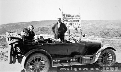
Editorial Negative - Mount Hotham, Victoria, 1928, A man and two women in a Buick car on the top of Mt Hotham. The sign in the background reads: 'Mt. Hotham 6200. Highest Coach Road in Australia. Omeo shire boundary...'.
- 2020-01-15
- 1
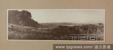
Editorial Mounted Photograph - Darby Flat Boundary Fence, Wilsons Promontory, Victoria, circa 1910, This image was taken by Baldwin Spencer during his tenure on the Wilsons Promontory board of Management. Spencer had been a leading figure in the campaign to make...
- 2020-01-15
- 1

Editorial Negative - Langi Kal Kal, Victoria, 1890, Three boundary riders mounted on horses with their dogs sitting nearby. The men are wearing long pants, shirts and jackets. One man wears a vest and all three wear hats and have a pipe in their mouth. Wooden fe...
- 2020-01-15
- 1
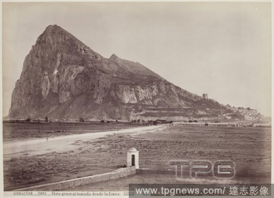
Editorial Juan Laurent, French, 1816-1892, Gibraltar, General View from the Boundary, between 1875 and 1900, albumen print, Image: 9 5/8 ? 13 3/8 inches (24.4 ? 34 cm).
- 2020-01-15
- 1

Editorial Hat slip from bobbin lace with rivi?res, Hat slip from natural-colored bobbin lace: Malines lace. Rivi?re with two leaf and flower stalks as its boundary, while a bunch of grapes stands on the fields in between. The scallops are flat and display medall...
- 2020-01-15
- 1
Editorial Watering Horses near a Boundary Marker. Dating: 1650 - 1668. Measurements: h 34 cm ? w 41 cm; d 5.5 cm.
- 2020-01-15
- 1
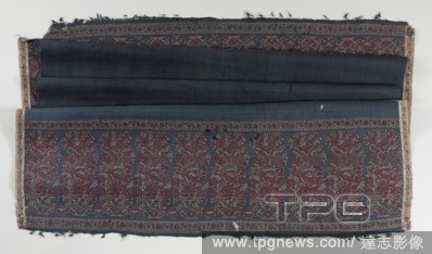
Editorial Scarf of night blue wool on both ends with a row of multicolored palm motifs and frills with knotted warp threads, Scarf of night blue wool with a row of multicolored palm motifs on both ends and frills with knotted warp threads. Pattern: a solid midni...
- 2019-12-18
- 1
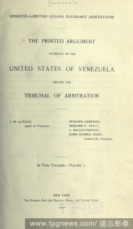
Editorial Venezuela-British Guiana boundary arbitration : the printed argument on behalf of the United States of Venezuela before the tribunal of arbitration : Venezuela.
- 2019-12-18
- 1
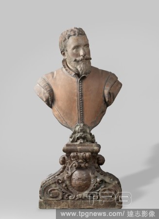
Editorial Bust of a Man Hendrik de Keyser (1565 - 1621) Bust of a man, The head, slightly turned to the right, shows a beard and toggle, fairly short hair and a somewhat fleshy nose. Over a piece of clothing that appears at the neck, he wears a jerky that is clo...
- 2019-12-18
- 1
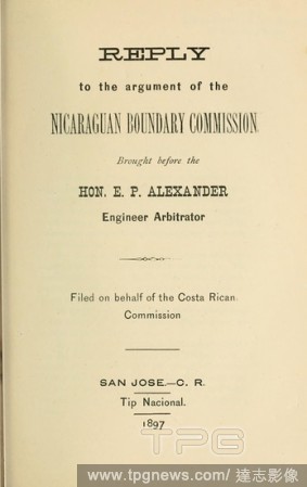
Editorial Reply to the argument of the Nicaraguan boundary commission brought before the Hon. E. P. Alexander, engineer arbitrator : Costa Rica. Comisi?n de l?mites.
- 2019-12-18
- 1

Editorial Napkin with a hunting scene, Napkin of linen damask with a hunting scene. Midfield: top left rider with longbow shooting at deer, far left: tree in which bear, top right: house for which water with two swans and on the right a house for which bridge on...
- 2019-12-18
- 1

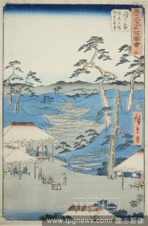
Editorial Hodogaya: Distant View of the Kamakura Mountains from the Rest House near the Boundary Tree (Hodogaya, Kyoboku tateba Kamakura yama enbo), no. 5 from the series "Famous Sights of the Fifty-three Stations (Gojusan tsugi meisho zue)," also known as the V...
- 2019-12-18
- 1
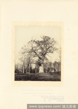
Editorial Parish Boundary Oak near Ascot Gate, James Sinclair, fourteenth earl of Caithness (British, 1821 - 1881), William Bambridge (British, 1819 - 1879), London, England, 1864, Albumen silver print, 27.6 ? 23.4 cm (10 7/8 ? 9 3/16 in.).
- 2019-11-19
- 1
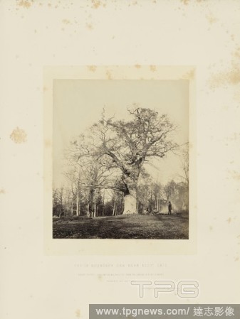
Editorial Parish Boundary Oak near Ascot Gate, James Sinclair, fourteenth earl of Caithness (British, 1821 - 1881), William Bambridge (British, 1819 - 1879), London, England, 1864, Albumen silver print, 27.5 ? 23.4 cm (10 13/16 ? 9 3/16 in.).
- 2019-11-19
- 1
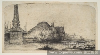
Editorial Cottage and Boundary Post on the Spaarndammerdijk ('L'Obelisque').
- 2019-11-18
- 1

Editorial Portrait of Shaoyu in the Guise of Liu Ling.
- 2019-11-18
- 1
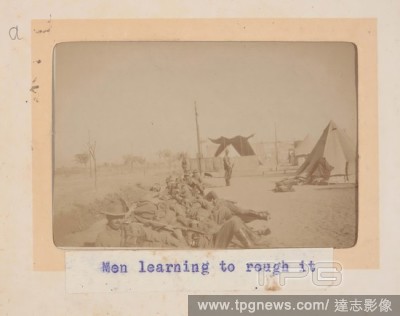
Editorial Photograph - 'Men Learning to Rough It', Egypt, Trooper G.S. Millar, World War I, 1914-1915, One of 49 photographs in an album from World War I likely to have been taken by Troop (later Lieutenant) G.S. Millar depicting the Light Horse camp in Egypt, 1...
- 2019-11-18
- 1
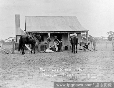
Editorial Negative - 'Boundary Rider's Hut, Portland Downs', Isisford District, Queensland, circa 1915, Men and horses outside a hut on 'Portland Downs' station. The hut is constructed from corrugated iron.
- 2019-11-18
- 1

Editorial Negative - Linton, Victoria, 1890, A boundary rider and his dogs on Mt Bute station.
- 2019-11-18
- 1

Editorial Krishna and Balarama within a Walled Palace: Page from a Dispersed Bhagavata Purana (Ancient Stories of Lord Vishnu).
- 2019-10-28
- 1
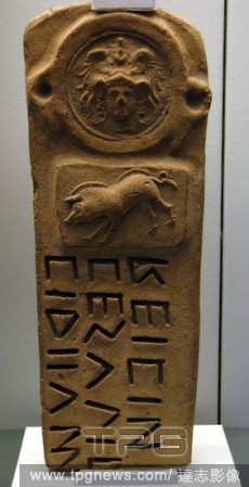
Editorial Boundary-marker with Oscan inscription. Used to mark the confines of sacred area. Decorated with reliefs depicting helmeted goddess Athena and a boar. Terracotta. 300-100 BC. From a tomb near Capua. British Museum. London. England. United Kingdom.
- 2019-09-16
- 1

Editorial The illustration shows Prince Selarasa on the far right, with two of his elder brothers paying their respects to a holy man. The sage's daughter, Ni Rumsari, had dreamt that three handsome men would come to visit. Behind her stands a female servant fr...
- 2019-07-16
- 1
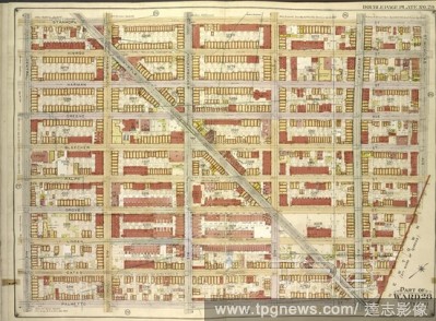
Editorial Brooklyn, Vol. 3, Double Page Plate No. 28; Part of Ward 28, Section 11; Map bounded by Stanhope St., St.Nicholas Ave., Boundary Line Borough of Brooklyn and Queens; Including Palmetto St., Central Ave.
- 2019-07-09
- 1

Editorial Brooklyn, Vol. 4, Double Page Plate No. 10; Part of Ward 26; Sections 12 & 13; Map bounded by Dumont Ave., Warwick St., New Lots Ave., Georgia Ave.; Sub Plan; Map bounded by Boundary Line of the Borough of Brooklyn and Queens, Elderts Lane;.
- 2019-07-09
- 1
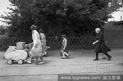
Editorial Before the Berlin Wall was built: even then, the " frontier" between the three Western sectors of Berlin and the Eastern, Soviet sector, could not be crossed without hard-to-get permits. Women and children hurry across the sector boundary. Be...
- 2019-05-16
- 1

Editorial Before the Berlin Wall was built: even then, the " frontier" between the three Western sectors of Berlin and the Eastern, Soviet sector, could not be crossed without hard-to-get permits. Women and children hurry across the sector boundary. Be...
- 2019-05-16
- 1
Editorial Hodogaya: Distant View of the Kamakura Mountains from the Rest House near the Boundary Tree (Hodogaya, Kyoboku tateba Kamakura yama enbo), no. 5 from the series "Famous Sights of the Fifty-three Stations (Gojusan tsugi meisho zue)," also known as the V...
- 2019-03-18
- 1

Editorial Cottage and Boundary Post on the Spaarndammerdijk ('L'Obelisque').
- 2019-02-22
- 1
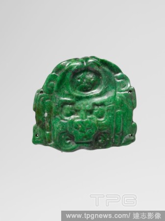
Editorial Deity Face Pendant.
- 2019-02-11
- 1

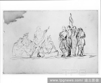
Editorial Study for Treaty with Native Americans (from Sketchbook).
- 2019-02-11
- 1
Editorial Study for Treaty with Native Americans (from Sketchbook).
- 2019-02-01
- 1

Editorial Watering Horses near a Boundary Marker. Dating: 1650 - 1668. Measurements: h 34 cm ? w 41 cm; d 5.5 cm.
- 2019-01-25
- 1
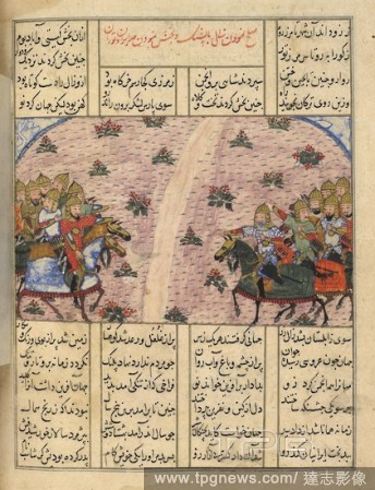
Editorial Zal and Zav reconciled. Shahnama. Iran, 1446. The reconciliation of the armies of Zal and Zav (the son of Tahmasp) and the drawing up of the boundary between Iran and Turan. A miniature painting from a fifteenth century manuscript of the epic poem of S...
- 2019-01-24
- 1
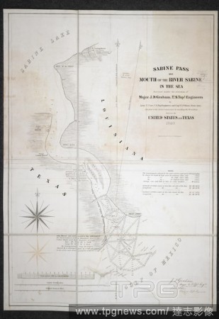
Editorial Sabine Pass. Sabine Pass and Mouth of the River Sabine in the S. [Washington?], 1840. Sabine Pass and Mouth of the River Sabine in the Sea. Image taken from Sabine Pass and Mouth of the River Sabine in the Sea. Surveyed under the Direction of Major J....
- 2019-01-24
- 1

Editorial Hodogaya: Distant View of the Mountains Around Kamakura from the Boundary Tree Resting Place, no. 5 from the series Collection of Illustrations of Famous Places near the Fifty-Three Stations [Along the Tokaido]. Date: seventh month 1855. Dimensions: 36...
- 2018-12-06
- 1

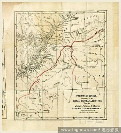
Editorial North America: Bowles' engraved map of the United States 1783, with a continuation of the boundary line in MS. . PLANS of military operations, in North America, etc. 1716-1783. Source: Add. 15535.
- 2018-12-06
- 1
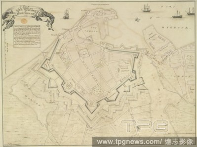
Editorial A plan of the town and fortifications of Portsmouth. A colored plan of the town and fortifications of Portsmouth, 1725, shewing the boundaries of the land belonging to the fortifications, as set off by Colonel Romer; the ground which was formerly the k...
- 2018-12-06
- 1
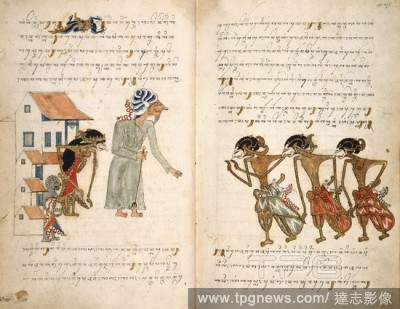
Editorial The illustration shows Prince Selarasa on the far right, with two of his elder brothers paying their respects to a holy man. The sage's daughter, Ni Rumsari, had dreamt that three handsome men would come to visit. Behind her stands a female servant fr...
- 2018-12-06
- 1
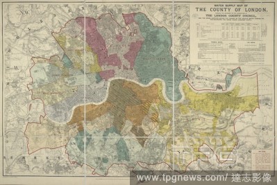
Editorial Water Supply Map of the County of London, 1892. Water Supply Map of the County of London, shewing the boundary of the jurisdiction of the London County Council, and the areas supplied ... by the various Water Companies, etc. London : E. Stanford, 1892....
- 2018-12-06
- 1
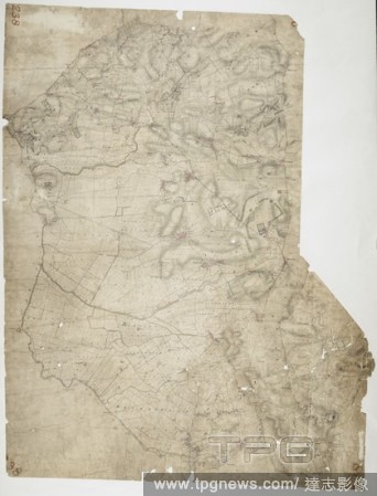
Editorial Feltwell St. Nicholas. The pecked red line following the course of the Little Ouse marks the county boundary of Norfolk and Cambridgeshire. Drawn on the left of the sheet, along the Ouse Valley, is a patchwork of arable land divided by straight water-f...
- 2018-12-06
- 1
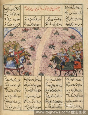
Editorial Zal and Zav reconciled. Shahnama. Iran, 1446. The reconciliation of the armies of Zal and Zav (the son of Tahmasp) and the drawing up of the boundary between Iran and Turan. A miniature painting from a fifteenth century manuscript of the epic poem of S...
- 2018-12-06
- 1

Editorial Map of Hampstead. The individual settlements that make up this area of London are shown by red blocks, with boundary lines indicating the fields separating them. Shading and soft interlining indicate relief, neatly illustrated at Primrose Hill, the su...
- 2018-12-06
- 1

Editorial Sabine Pass. Sabine Pass and Mouth of the River Sabine in the S. [Washington?], 1840. Sabine Pass and Mouth of the River Sabine in the Sea. Image taken from Sabine Pass and Mouth of the River Sabine in the Sea. Surveyed under the Direction of Major J....
- 2018-12-06
- 1
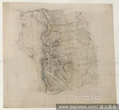
Editorial This drawing covers the boundary between the counties of Cardiganshire and Montgomeryshire. The border is marked as a red pecked line, following the course of the River Dovey for much of its length. Archaeological sites are noted in gothic script, an o...
- 2018-12-06
- 1
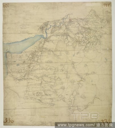
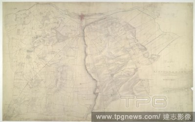
Editorial This plan covers an area of 82.625 square miles in Nottinghamshire and Lincolnshire. The county boundary is indicated by a red pecked line following the course of the River Trent down the right of the sheet. Land use is indicated by colours instead of ...
- 2018-12-06
- 1

Editorial A map illustrating the disputed boundary between the United States and Mexico. Map illustrating the disputed Boundary between the United States and Mexico. Compiled ... & drawn by G. Schroeter. New York, 1853. Source: Maps 71495.(25.). Language: English.
- 2018-12-06
- 1
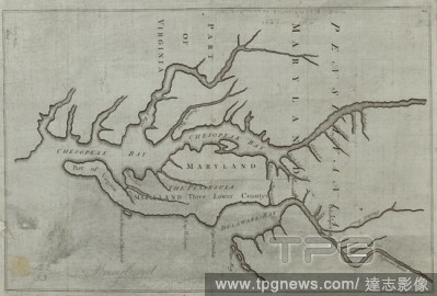
Editorial A map of the proposed Maryland/Pennsylvania boundary. Proposed Maryland / Pennsylvania Boundary. [London] : [John Senex], [1735.]. Copperplate engraving. Source: Maps K.Top.122.33. Language: English.
- 2018-12-06
- 1
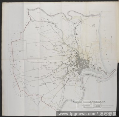
Editorial A map of Aberdeen. Maps of the proposed boundaries of cities, burghs and towns in Scotland drawn up by Boundary Commissioners in respect to parliamentary representation under the Reform Bill of 1832. Source: Maps 145.c.27.(2.) plate opposite page13. La...
- 2018-12-06
- 1
Editorial Welford. This drawing depicts the boundary of Leicestershire and Northamptonshire. The county border is indicated at top left by a pecked line following the course of the River Avon. Relative relief is depicted by brushwork interlining ('hachuring') an...
- 2018-12-06
- 1
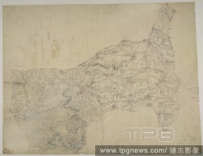
Editorial This drawing shows the county boundary of Lincolnshire and Nottinghamshire as a red dotted line down the left of the sheet. The county town is depicted at the top of the plan on the north bank of the river Witham, set on the summit of the limestone rid...
- 2018-12-06
- 1
Editorial A map of Chiddingfold. A turnpike road, coloured ochre yellow, forms a boundary from Hascombe at the top right of the map to 'Aldfold' at the bottom. Common land and dense woodland dominate the region to the left around Hindhead Valley and the Devil's ...
- 2018-12-06
- 1
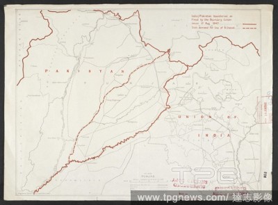
Editorial Map showing India and Pakistan boundaries, dated 1947. India / Pakistan boundaries as fixed by the Boundary Commission 17 Aug 1947, OR 6409. London : War Office, 1947. 1 map : col.; Scale 1:2 000 000. Source: Maps MOD OR 6409.
- 2018-12-06
- 1
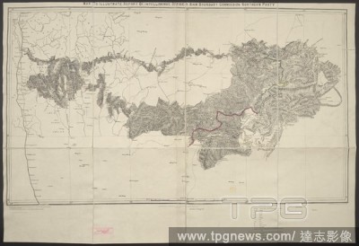
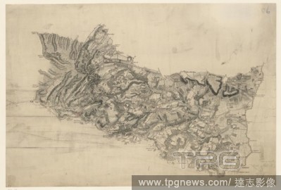
Editorial 'Map to illustrate report of intelligence officer, Siam Boundary Commission Northern Party'. Map to illustrate report of ... Siam Boundary Commission, Northern Party. Scale, 8 miles = 1 inch. Calcutta : Survey of India Offices, 1893. Source: Maps 60122...
- 2018-12-06
- 1
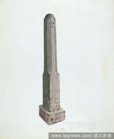
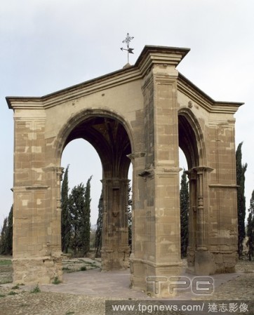
Editorial Plantation Boundary Marker. Dated: c. 1938. Dimensions: overall: 44.5 x 36.5 cm (17 1/2 x 14 3/8 in.). Medium: watercolor and graphite on paper.
- 2018-11-29
- 1

Editorial Cottage and Boundary Post on the Spaarndammerdijk ('L'Obelisque').
- 2018-11-21
- 1
Editorial Spain. La Rioja. Calahorra. Boundary cross. 16th century.
- 2018-10-11
- 1

Editorial Plantation Boundary Marker. Dated: c. 1938. Dimensions: overall: 44.5 x 36.5 cm (17 1/2 x 14 3/8 in.). Medium: watercolor and graphite on paper.
- 2018-09-18
- 1

Editorial Boundary-marker with Oscan inscription. Used to mark the confines of sacred area. Decorated with reliefs depicting helmeted goddess Athena and a boar. Terracotta. 300-100 BC. From a tomb near Capua. British Museum. London. England. United Kingdom.
- 2018-08-21
- 1

Editorial Cottage and Boundary Post on the Spaarndammerdijk ('L'Obelisque').
- 2018-08-09
- 1
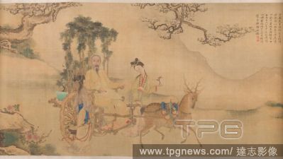
Editorial Portrait of Shaoyu in the Guise of Liu Ling.
- 2018-08-06
- 1

Editorial Deity Face Pendant.
- 2018-08-06
- 1
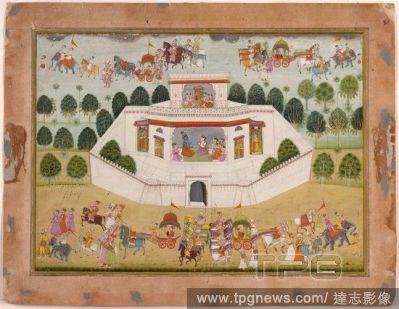
Editorial Krishna and Balarama within a Walled Palace: Page from a Dispersed Bhagavata Purana (Ancient Stories of Lord Vishnu).
- 2018-08-06
- 1
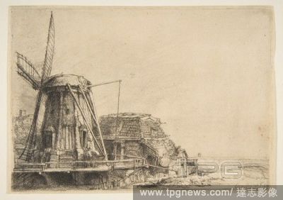
Editorial The Windmill.
- 2018-08-06
- 1

Editorial Study for Treaty with Native Americans (from Sketchbook).
- 2018-08-06
- 1

Editorial Cabinet (Fassadenschrank).
- 2018-08-06
- 1

Editorial A Waterfall, Moonlight.
- 2018-08-06
- 1
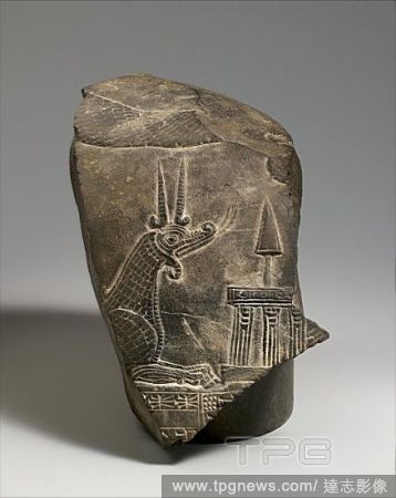
Editorial Top fragment of a kudurru with a mushhushshu dragon and divine symbols, Second Dynasty of Isin, ca. 1156?1025 B.C., Mesopotamia, Limestone, H. 6 1/2 x W. 4 x D. 7 1/4 in. (16.5 x 10 x 18.4 cm), Stone-Sculpture-Inscribed, Known as kudurrus or narus, a d...
- 2018-08-03
- 1
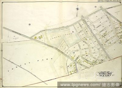
Editorial Queens, Vol. 2, Double Page Plate No. 44; Part of Ward Two Newtown; Map bounded by Union Turnpike, Hoffman Boulevard, Lefferts Ave., Muller Ave.; Including Augustin Ave, Newtown Road, Boundary line between Jamaica and Newtown, Long Island R.
- 2018-07-31
- 1
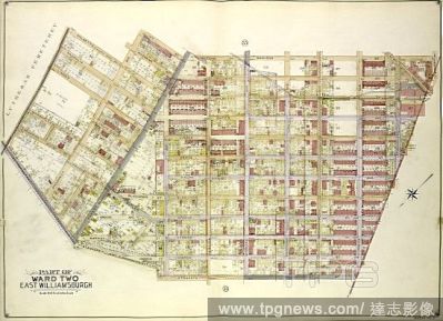
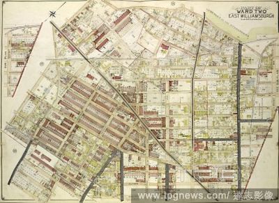
Editorial Queens, Vol. 2, Double Page Plate No. 34; Part of Ward Two East Williamsburgh; Map bounded by Palmetto St., Prospect Ave., Ivy St., Forest Ave., Ptnan Ave., Woodard Ave., Madison St., Myrtle Ave.; Including Boundary Line between borough of Qu.
- 2018-07-31
- 1
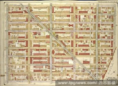
Editorial Brooklyn, Vol. 3, Double Page Plate No. 28; Part of Ward 28, Section 11; Map bounded by Stanhope St., St.Nicholas Ave., Boundary Line Borough of Brooklyn and Queens; Including Palmetto St., Central Ave.
- 2018-07-31
- 2
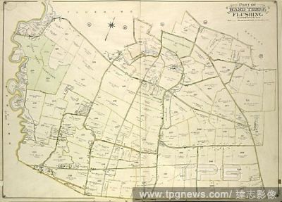
Editorial Queens, Vol. 3, Double Page Plate No. 19; Part of ward Three Flushing; Map bounded by Strongs Causeway Ireland, Mill Road, North Hempstead Turnpike, Crop Road, Union Ave., Hoffman Ave., Boundary Line of Flushing, Jamaica, Head of the Vlei.
- 2018-07-31
- 1

Editorial Queens, Vol. 2, Double Page Plate No. 43; Part of Ward Two Newtown; Map bounded by Metropolitan Ave. Williams Burg Turnpike, Ward Boundary line between Newtown and Jamaica, Myrtle Ave., Trotting Course Lane, Ocean View Ave.; Including Ma.
- 2018-07-31
- 2
Editorial Queens, Vol. 2, Double Page Plate No. 35; Part of Ward Two East Williamsburgh; Map bounded by Cooper Ave., Moffatt St., Irving Ave., Boundary line between borough of Queens and Brooklyn, Wyckof Ave., Madison St. Ivy St., Putnam Ave., Forest.
- 2018-07-31
- 1
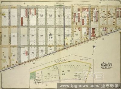
Editorial Brooklyn, Vol. 4, Double Page Plate No. 10; Part of Ward 26; Sections 12 & 13; Map bounded by Dumont Ave., Warwick St., New Lots Ave., Georgia Ave.; Sub Plan; Map bounded by Boundary Line of the Borough of Brooklyn and Queens, Elderts Lane;.
- 2018-07-31
- 1
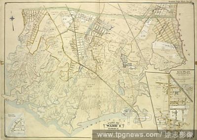
Editorial Queens, Vol. 1, Double Page Plate No. 19; Part Of Ward 4; Jamaica; Map bounded by Conduit Long Island R.R., Boundary Line Of The City of New York; Including Hook Canal Creek, Jamaica Bay, Dead or Salt Creek.; Sub Plan From Plate No. 17 Map bou.
- 2018-07-31
- 1
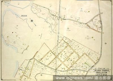
Editorial Queens, Vol. 3, Double Page Plate No. 21; Part of ward Three Sub Plan; Map bounded by Little Neck Bay, Odalls Cove; Including Bay St., Allen St.; Part of ward Three Douglaston and Little Neck; Map bounded by Boundary Line of City of New York a.
- 2018-07-31
- 1

Editorial Near East. Mesopotamia. Kudurru (boundary stone). Babylonia. Cassite Period (1550-1155 BC). Iraq. The State Hermitage Museum. Saint Petersburg. Russia.
- 2018-07-30
- 1
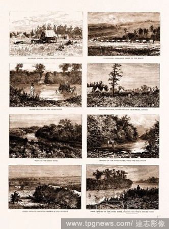
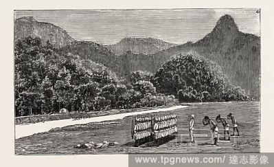
Editorial BRITISH NORTH AMERICA (CANADA), 1881: ON THE SOUTH-WESTERN FRONTIER: BOUNDARY SURVEY CAMP, TURTLE MOUNTAIN; A BOUNDARY COMMISSION TRAIN ON THE MARCH; SECOND CROSSING OF THE SOURIS RIVER; TURTLE MOUNTAIN, NORTH-WESTERN TERRITORIES, CANADA; VIEW ON THE S...
- 2018-07-30
- 1

Editorial The right of the United States of America to the North-Eastern boundary claimed by them, map, 19th century engraving.
- 2018-07-30
- 1

Editorial Map of North America, The right of the United States of America to the North-Eastern boundary claimed by them, 19th century engraving.
- 2018-07-30
- 1

Editorial Wharf Cottage, Tibshelf Wharf, Situated on Mansfield Road, beyond which is the Derbyshire / Nottingham county boundary, UK, art, art Britain, Artist: Sarah Smith.
- 2018-07-27
- 1

Editorial Watering Horses near a Boundary Marker, Philips Wouwerman, 1650 - 1668.
- 2018-07-27
- 1
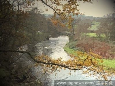
Editorial The River Etherow, This river forms a winding county boundary between Derbyshire and Greater Manchester, UK, art, art Britain, Artist: Sarah Smith.
- 2018-07-27
- 1

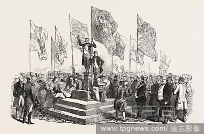
Editorial THE QUEEN'S VISIT TO THE EAST END, LONDON, UK, 1876: THE PROCESSION PASSING THE TRIUMPHAL ARCH AT THE CITY BOUNDARY.
- 2018-07-27
- 1
Editorial Quebec 1776, The right of the United States of America to the North-Eastern boundary claimed by them, 19th century engraving.
- 2018-07-27
- 1

Editorial Coldwall Bridge, Single-arched bridge over the River Dove on the Derbyshire-Staffordshire county boundary, UK, art, art Britain, Artist: Sarah Smith.
- 2018-07-27
- 1
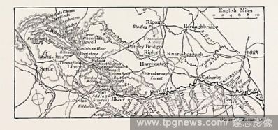
Editorial MAP OF THE COURSE OF THE WHARFE, UK. The River Wharfe is a river in Yorkshire, England. For much of its length it is the county boundary between West Yorkshire and North Yorkshire. The name Wharfe is Celtic and means twisting, winding.
- 2018-07-25
- 1
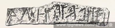
Editorial BOUNDARY STONE OF GEZER, IN PALESTINE, DISCOVERED BY M. CLERMONT-GANNEAU, 1874.
- 2018-07-25
- 1
Editorial THE EXPEDITION AGAINST THE AKHA MARAUDERS ON THE FRONTIER OF ASSAM: AKHA CHIEF FOLLOWERS, AND ESCORT OF THE FORTY-SECOND ASSAM LIGHT INFANTRY SALUTING AFTER THE ERECTION OF A DISPUTED BOUNDARY PILLAR.
- 2018-07-25
- 1
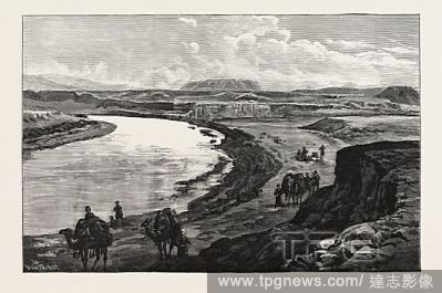
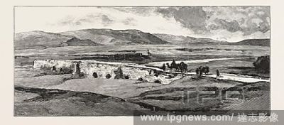
Editorial THE AFGHAN BOUNDARY: JUNCTION OF THE MURGHAB AND KUSHK RIVERS, AK-TAPA IN THE DISTANCE, 1885.
- 2018-07-25
- 1
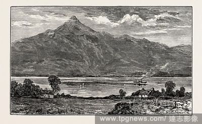
Editorial BEN AND LOCH LOMOND, UK. Loch Lomond is a freshwater Scottish loch, lying on the Highland Boundary Fault.
- 2018-07-25
- 1
Editorial THE LORD MAYOR'S VIEW OF THE THAMES: THE CEREMONY AT THE BOUNDARY STONE, AT STAINES, UK, 1846.
- 2018-07-25
- 1
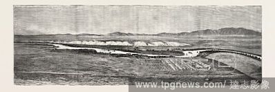
Editorial THE CAMP OF THE AFGHAN BOUNDARY COMMISSION NEAR TIRPUL, IN THE VALLEY OF THE HARI-RUD.
- 2018-07-25
- 1
Editorial THE AFGHAN BOUNDARY: THE KUSHK, VALLEY FROM PULI-I-KHISTI, LOOKING SOUTH, 1885.
- 2018-07-25
- 1

Editorial STIRLING, FROM ABBEY CRAIG, UK. Stirling is a city and former ancient burgh in Scotland, and is at the heart of the wider Stirling council area. The city is clustered around a large fortress and medieval old-town beside the River Forth. Historically it...
- 2018-07-25
- 1
 Loading